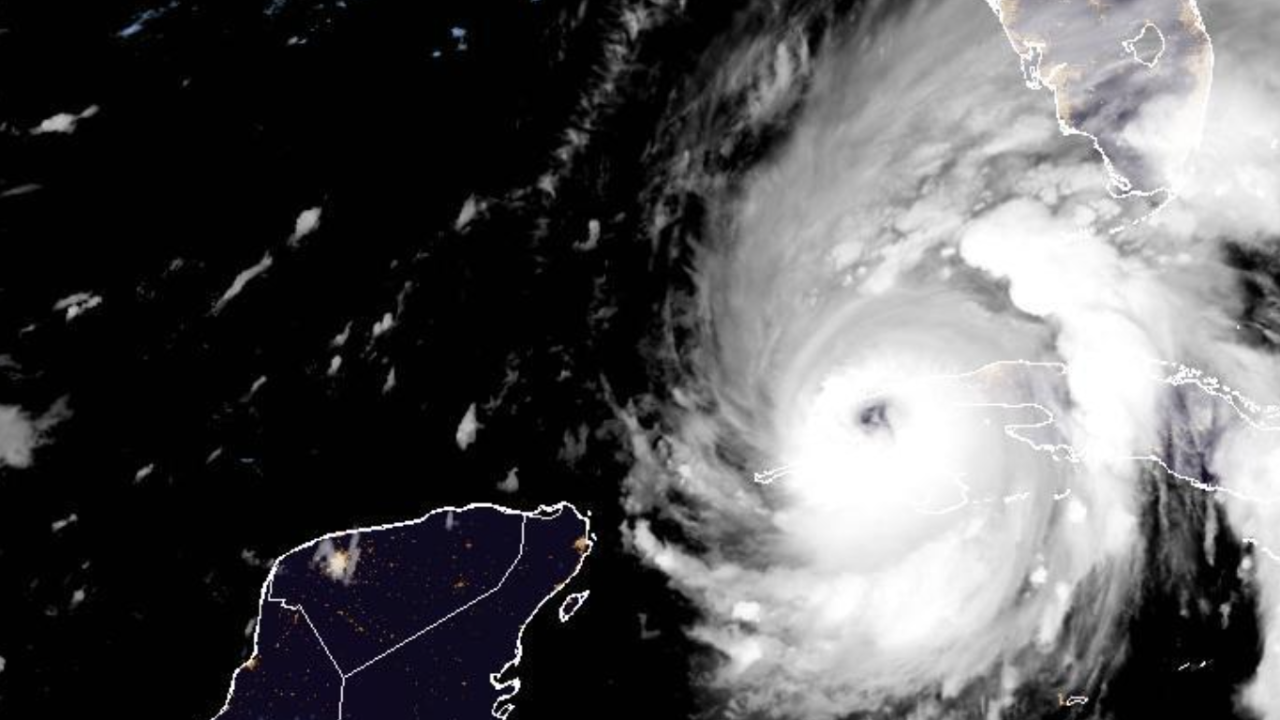
The hurricane became a fierce Cat 4 Wednesday as its track shifted, pushing rains onto Florida as the eye of the storm approached the U.S.
The hurricane caused tornado warnings for a vast swath of the southern portion of Florida. Tornados in these hurricane conditions are typically strong and pop up without much notice, CNN reported.
The hurricane’s brief interaction with land on the western side of the island of Cuba prevented it from intensifying, but only temporarily. Ian struck Cuba with top sustained winds of 125 mph early Tuesday, pushing the entire country into a total electrical blackout.
RELATED: State media: Cuba in nation-wide blackout after Hurricane Ian hits
Ian is expected to make landfall along Florida's southwest Gulf Coast Wednesday. The National Hurricane Center (NHC) said, "life-threatening storm surge is increasingly likely along the Florida west coast."
While the National Hurricane Center's forecast originally called for the storm to make a direct landfall near the Tampa area, Florida Gov. Ron DeSantis said the forecast now takes the storm closer to Sarasota.
The White House said it has been tracking the storm, and President Joe Biden spoke with Gov. DeSantis on Tuesday.
Biden said, "(The) forecast can change, but for now the experts say this could be a very severe hurricane, life-threatening and a devastating impact."
The president said, "The administration is on alert and in action to help the people of Florida."
"The President and the Governor committed to continued close coordination," White House Press Secretary Karine Jean-Pierre said.
President Biden spoke this evening with Governor DeSantis of Florida to discuss the steps the Federal government is taking to help Florida prepare for Hurricane Ian. The President and the Governor committed to continued close coordination.
— Karine Jean-Pierre (@PressSec) September 27, 2022
There is a storm surge warning for areas of Florida's western Gulf Coast. The areas between Naples and Sarasota are at the highest risk, NHC said.
Shelters have opened throughout Florida as coastal areas are being evacuated due to potentially high storm surges. Gov. DeSantis said 2.5 million residents are under some sort of evacuation order.
“When you have 5 to 10 feet of storm surge, that’s not something that you want to be a part of," DeSantis said.
"You do not need to go hundreds of miles away. These counties have shelters available," DeSantis said.
NHC said Hurricane-force winds are expected in southwest and west-central Florida starting Wednesday morning. Those winds are expected to be downgraded to tropical storm strength in the overnight hours into Thursday.
The hurricane warning area, NHC expects "devastating wind damage" in areas near Hurricane Ian's core.
Forecasters warn the storm could dump 12-16 inches of rain in parts of Florida. The National Hurricane Center also warns of up to 8-12 feet of storm surge for the area, an increase from previous storm surge forecasts.
NHC says heavy rainfall is expected over the next several days. The rain will spread to other southern U.S. states by Thursday and Friday. Flash flooding could be expected outside of Florida as the storm moves on.
Despite the revised path, officials urged those in the Tampa area who evacuated to stay away as the storm's potential direct path could still change.
DeSantis said tolls are suspended, and certain other regulations were lifted.


