The best laid plans may be indoors this weekend. We are tracking a soggy set-up as the remnants of Tropical Storm Gordon and a stalled front spread heavy rain across the Bluegrass.

For a few days now we’ve been telling you about Gordon. The storm made landfall as a tropical storm late Tuesday night near the Alabama-Mississippi coast. Since then the storm has slowly tracked through the lower Mississippi Valley. What is left of Gordon will be picked up by an upper-level disturbance, and will follow a path set up by a stalled front through the Ohio Valley this weekend.

Flash flood watches have been issued for areas along the path of Gordon’s remnants. This is where the axis of heaviest rain will set up. Three to five inches of rain will be possible between St. Louis and Cleveland by late Monday.
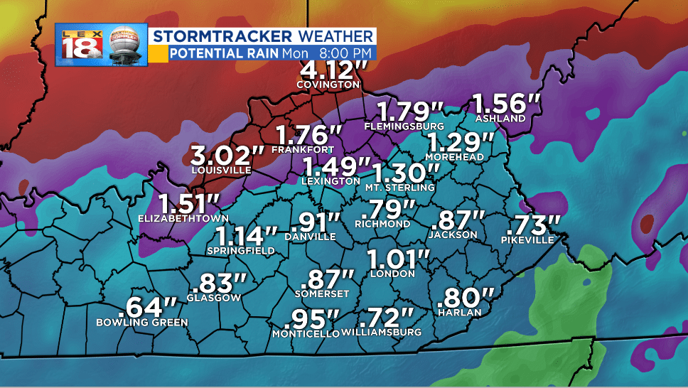
Even on the southern side of this tropical system, central and eastern Kentucky will pick up a lot of water. One to two inches of rain will be possible by Monday; higher amounts are expected north and northwest than across southeastern counties. Most of this rain will fall Saturday night through Monday morning as tropical downpours from Gordon move through the Bluegrass. With this amount of rain localized flash flooding concerns may arise. Water may flow over roads, creeks spill out of their banks. Main-stem rivers should be able to handle this amount of rain just fine.
![]()
Stay ahead of this weekend’s soggy conditions with the LEX 18 StormTracker Weather app. If you haven’t downloaded it yet, you should. I promise this isn’t a shameless plug. It really is a great tool to have on hand when active weather strikes. All the important tools are in one spots on your favorite devices.
