Alright fall lovers, the countdown is on! The Autumnal Equinox is this Saturday. But… as we slide into autumn we are going to be missing an important ingredient.

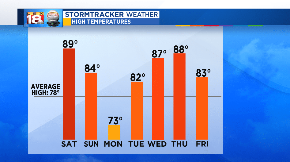
Outside of a cool down on Monday as the remnants of Florence pass through eastern Kentucky, the temperature trend still very much says summer this week. Highs will bounce back to the low 80s after the rain is gone Tuesday. Then we are tracking more mid-summer heat and humidity Wednesday and Thursday. Could we even add another tally to our 90-degree total? Yes, it’s possible Thursday. 90 degrees or not, the heat index will be in the low to mid 90s.
The Climate Prediction Center (CPC) gives central and eastern Kentucky a 60% chance of seeing above-average temperatures over the next six to ten days. A mid-level ridge will set-up over the Southeast, which will continuously pump in the heat and humidity. Very typical summertime pattern there. As the ridge wiggles, even weather systems can’t stand still for a long time, storms will try and sweep into the Bluegrass. Thunderstorms and the occasional cold front may bring highs down by a few degrees or below-average, but only briefly.

With these good chances for above-average temperatures it’s not to say that a cooler day won’t pop into the 8 Day Forecast along the way. Still not encouraged and looking for more?

The CPC also provides a week 3 and 4 temperature outlook. It looks like by mid-October the hot and muggy air will be pushed south. The odds will change, and then maybe we’ll catch some of that cool, crisp air.
