Here’s a soggy stat for you. Lexington has recorded at least a few hundredths of an inch of rain every weekend this month. This weekend was no different. And once again we dealt with flooding issues. There will be several more rounds of soaking rain to track into central Kentucky through Wednesday.

Flash flood watches have been extended across central and eastern Kentucky. Additional heavy rain that falls on an already saturated soil will likely cause flooding. Swollen streams and creeks will also have to be watched.
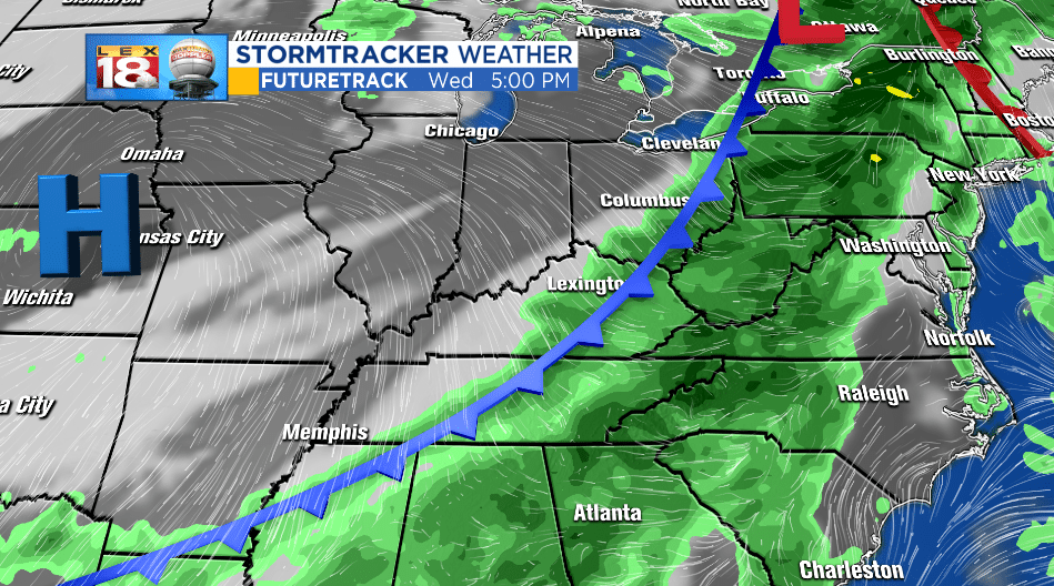
What will bring all of this rain? A stalled boundary will be on the move, slowly, Monday as a warm front. This will put the Commonwealth in the warm sector. A high moisture content will lend itself to impressive rainfall rates. Heavy, even torrential rain won’t be out of the question over the next few days. A few gusty to strong thunderstorms could also develop.
A cold front will track through on Wednesday. This will ultimately shut down the wet set-up. Periods of persistent and soaking will still be around as the cold front pushes through the Bluegrass.
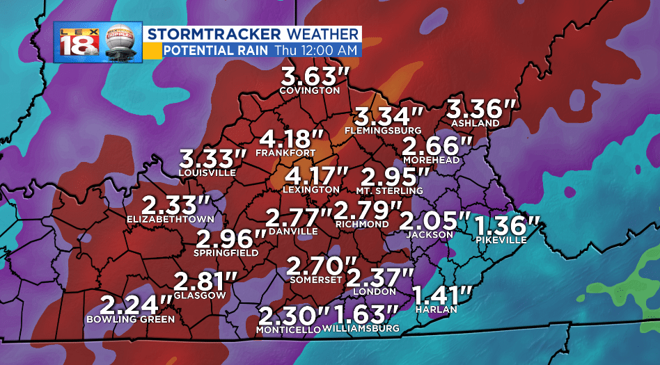
Generally one to three inches were recorded this weekend. Rain through Wednesday could add an additional two to four inches. Now you see why flooding to going to remain an issue.

The remnants of Florence and Gordon were significant rain makers this month. Prior to this weekend, 2018 sat in fifth place for the wettest September in Lexington. With the addition of the weekend rainfall, we now sit in third place. A record rainfall seems easily within reach over the final six days of the September.
