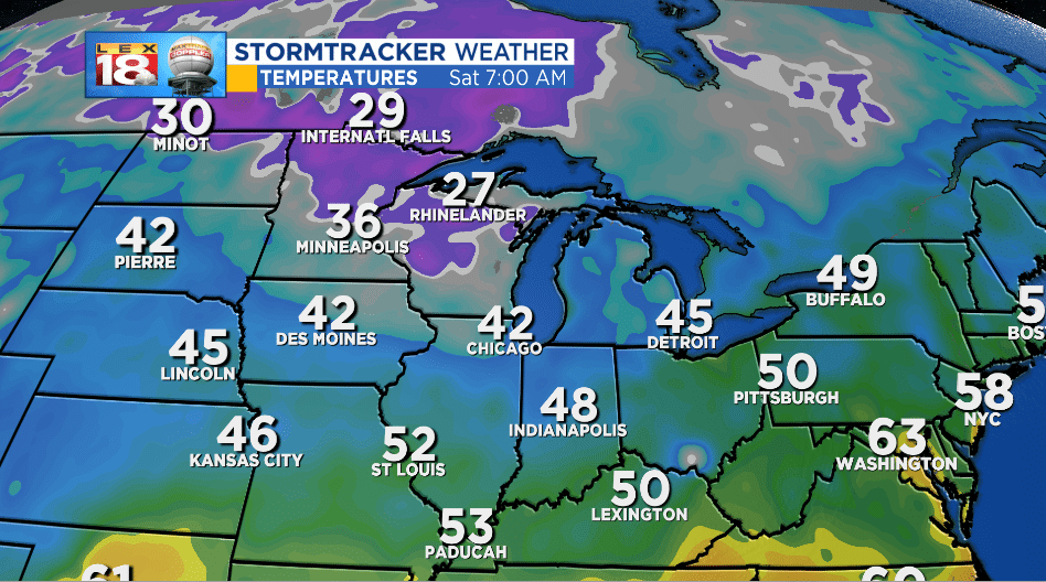
We’re starting to see the first real signs of fall cropping up. After the rain stopped, fall begin in the Bluegrass. The past three nights have been cooler than the last with lows in the lower 50s. As you can imagine, it was even colder up north. Most of Minnesota and Wisconsin were under frost advisories and freeze warnings last night.
Snow has also started to fly across the northern Rockies. Yellowstone and Jackson Hole have received measurable snow over the past few weeks.

But it doesn’t look like fall is here to stay in the Bluegrass. Entering October we are tracking some “fall heat.” This weekend ends with highs in the upper 70s to 80 degrees across southern Kentucky. Most will join the 80-degree party on the first day of October and stay there through late week.
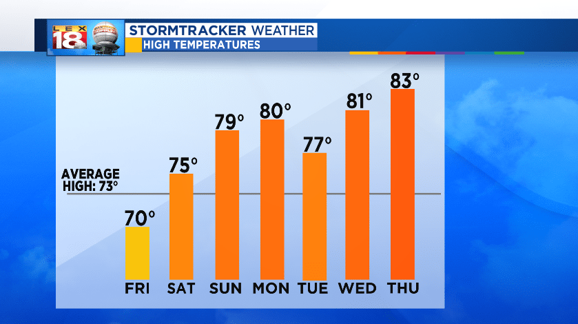
Lexington’s average high temperature steadily drops during the fall. Over the first week of October the average high falls from 73° to 70°. So the highs in the lower 80s next Thursday and Friday will be unseasonably warm. And it’s not just the afternoon temperatures that will be unusually warm. We are tracking lows in the mid 60s.
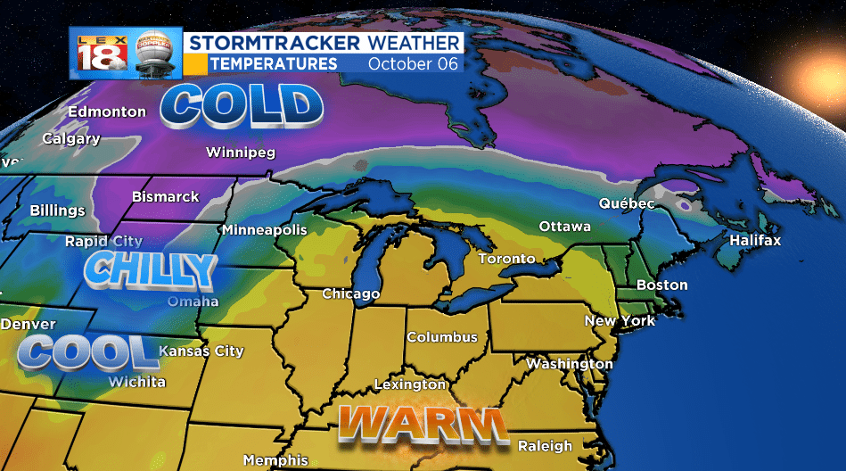
Model trends keep temperatures above-normal through next weekend. But a colder airmass will start spilling across the Plains. A ridge of high pressure will keep all the cold stuff to the north and west of the Commonwealth. Once that bubble breaks/tracks east more of that “pumpkin spice air” will filter into the Bluegrass. So it’s not time to pull all of your jeans and wool sweaters out of the closet just yet. Summer isn’t ready to quit.
