Michael is long gone but the damage left behind will take months to years to clean up. We’ve seen damage from the ground and air, but the satellite images before and after tell a much different story. Using the visible satellite imagery, we can see just how much damage the states of Florida and Georgia have taken.

Looking at the before image, not much stands out. A lot of green is in place as the trees were still leaved from the warm weather experienced there.

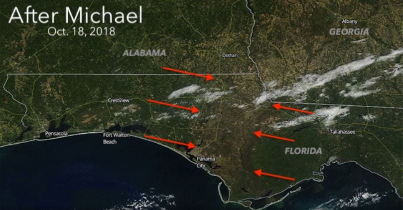
However, the after image shows the impact of the hurricane force winds felt from the Florida Panhandle to Southwest Georgia. A damage scar from the coast to near Albany, GA can be clearly seen on the after-Michael imagery. The scar is 35 miles wide and 120 miles long. Homes, businesses, timber, and crops were all lost or damaged as the 100+ mph winds swept onshore.
The price tag for timber damage in the two states will total near $2.3 billion and agriculture will likely run several billion as well.

Cotton will take a big hit in both states as some fields have been completely destroyed. Other big industry hits will be pecans, poultry, corn, squash, and tomatoes