All day, wintry mix showers have been spitting across the state. Temperatures were above freezing most of the day, so accumulation was not present. Temperatures, hovering right above freezing, will begin to dip below as the sun goes down. This will allow surfaces to drop to freezing and ups the chances for snow collection.

Amounts will generally run between a few tenths of an inch and up to an inch for areas in the Bluegrass, Southern and Eastern Kentucky. Snow showers will run light to moderate and will be scattered at best. This means that not all areas will hit the inch mark, but some will. It depends on where the heavier showers line up.

Timing on accumulation will run between later tonight and through the late morning tomorrow. Roads will still be too warm for accumulation during the evening traffic today. Bridges and overpasses will be first to start collecting as exposed and elevated roads cool quicker. Road surfaces will likely begin to see sticking around and after midnight and through the morning commute tomorrow.
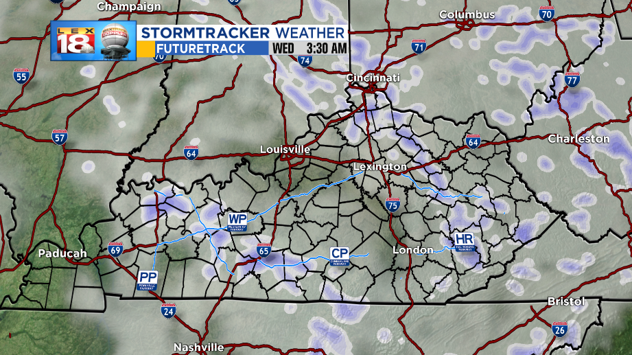
A WINTER WEATHER ADVISORY will be in effect from this evening through early Wednesday Afternoon. The Bluegrass will have snow coming to an end earlier than those living east of I-75. By noon, most of (if not all) snow showers will be exiting the state.

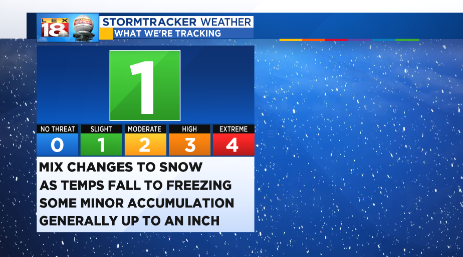
The StormTracker Threat Index has been raised to a level ONE or SLIGHT through tomorrow morning. While this is a minor event, roads will still be slippery enough to cause traffic issues. If you don’t need to be on the roads overnight, don’t be. The more traffic on the roads when snow begins to stick, the better the chance for accidents. Use caution through the morning commute as snow could still be falling and collecting.
Stay with the StormTracker Weather Team for information and updates regarding the winter weather overnight. You can find more information at the LEX 18 Weather Page and on the FREE StormTracker Weather App.

