Warm, wet, and windy conditions are in our future over the next 48 hours. We are tracking a dynamic storm system to move through the Central Plains and into the Great Lakes. This system will bring severe storms and heavy snow to the middle of the country. Meanwhile here in the Bluegrass, our impacts will be a little more subdued.
Unseasonable Warmth

Let’s start with some good news. The southern and eastern flanks, where we will be, is the “warm” side of this approaching system. A strong south wind will send temperatures close to 60° over the next two days. That’s nearly 20 degrees above-normal.
Gusty Winds

Strong southerly winds will help to drive temperatures up. Wind gusts of 30 to 40 mph will be possible in between the warm and cold fronts of this potential system. A Wind Advisory will kick in Thursday morning and continue through the start of Friday. You’ll want to anchor your inflatables and other outdoor Christmas decorations.
Wet and Stormy

We are only worried about rain with this dynamic storm system. A line of showers will track in Thursday evening. Some heavy rain and embedded gusty thunderstorms will be possible. This won’t be a prolonged rain. There will be bursts of rain, heavy at times. Rainfall amounts through Friday evening should be less than inch.
Wintry Weather
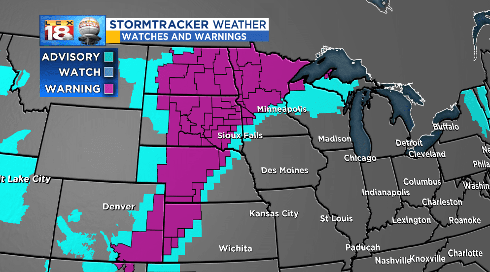
The only “W” type of weather missing from our forecast will be wintry conditions. The northern and western side of the side will tap into cold air. There will be the possibility of heavy snow, even blizzard conditions across the Northern Plains and Upper Midwest.
