If you didn’t want to wait in the long car wash lines the past couple of days you are in luck. Over the next two days a soaking rain will supply us all with a FREE car wash! A stalled front will continue to funnel round after round of rain into the Bluegrass through Thursday night. Rain could be heavy at times, leading to flooding concerns, and a few gusty thunderstorms will be possible. For these reasons we have raised the LEX 18 Threat Index at a Level 1, or slight risk.

The greatest threat over the day and a half will be the repeated dose of rain. We are tracking the potential for two to four inches of rain through Thursday night. This amount of rain over a relatively short period of time will be enough to cause some flooding. Heavy rain will only exacerbate the threat.

As of 2 PM, northern Kentucky and north of Lake Cumberland had received the most rain according to the Kentucky Mesonet. The area of heaviest rain tonight will be focus across south-central Kentucky. These areas have seen less than a half inch of rain so far. The entire LEX 18 area will see the potential for more heavy rain Thursday evening.
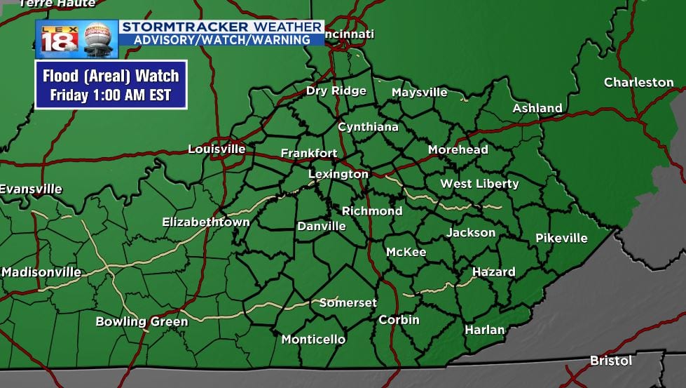
There is going to be a lot of runoff with this rain event. The ground is frozen and not effectively soaking up with the water. Flooding especially in low-water crossings is likely. Rises of the the Elkhorn Creek and other area streams, creeks, and rivers are also possible. Use EXTREME caution if you live near or travel through typical low-water crossings. Never drive through flood waters. Turn around, not drown.
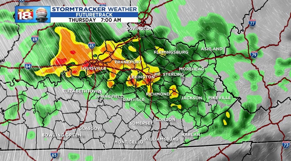
The strong and severe storm chances are relatively low, but not zero. We are tracking the potential for a few gusty thunderstorms, especially Thursday. The ingredient aren’t there for widespread stronger storms. The primary threat will be for strong wind gusts. These thunderstorms will also be capable of putting down heavier amounts of rain.
Rain will come to an end with a passing cold front Thursday night. This will set us back closer to normal on Friday and this weekend.
