Our dry time is unfortunately limited. The next batch of rain is heading northward this evening. Most of the rain with this next round will be focused across southern Kentucky. Just the area that doesn’t need more rain this soon. Activity will be more scattered for the Bluegrass and northern Kentucky. The good news is most of this rain will be on the light side through Friday evening.

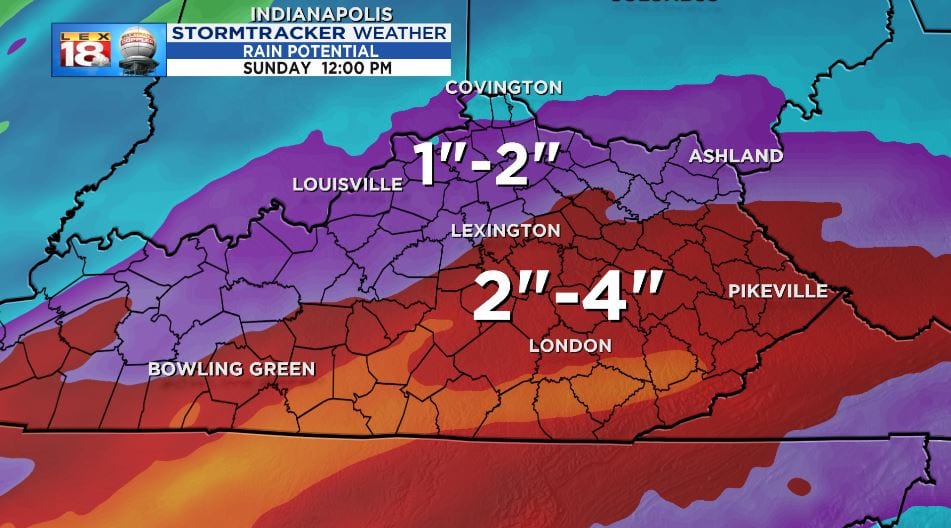
A more potent storm system is heading our way on Saturday. This will renew our chances for heavy rain. More widespread rain will sweep across the Bluegrass. Activity will wind down by early Sunday morning. By that point an additional one to two inches of rain will be possible for central Kentucky, meanwhile southern and southeastern counties could receive up to four inches. That’s another month’s worth of rain!
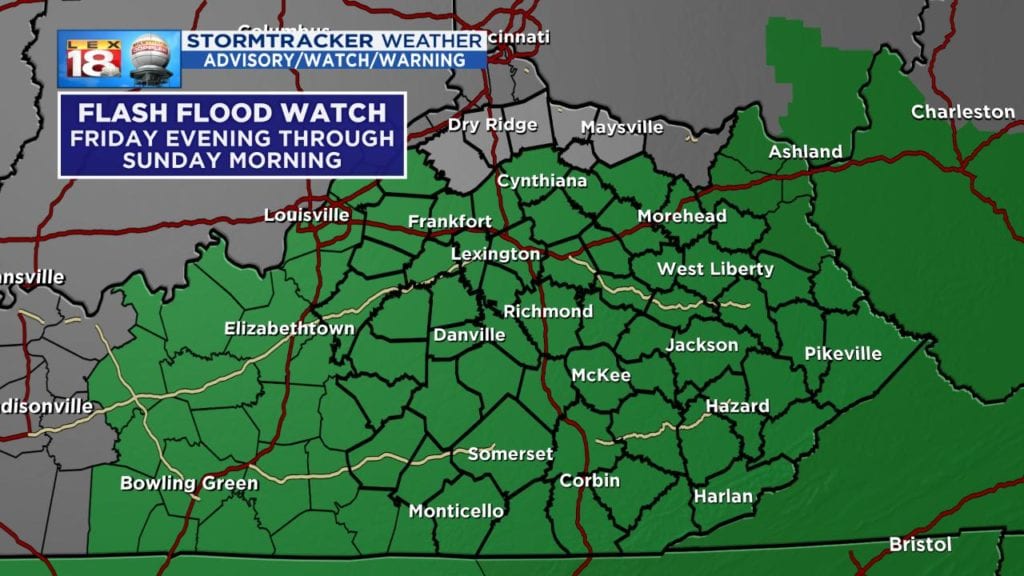
The ground is already very saturated, and there won’t be much time for things to dry out. You can think of it like a soppy wet sponge. If you run it under a faucet, the extra water just rolls off the porous surface. Additional heavy rainfall will contribute to excessive runoff, and this runoff will likely cause more flooding. And that flooding may occur quickly. A Flash Flood Watch will be in effect for the entire area between Friday evening and Sunday morning. Expect water issues in low-lying and poor drainage areas. Small streams may rise out of their banks; larger creeks and streams may rise further. The additional rainfall could also aggravate river flooding.
As if a heavy rain threat isn’t enough, we are also tracking a strong storm threat as a potent cold front blows through Saturday evening. The highest threat appears to be across western Kentucky. A gusty thunderstorm or two could cross into the Bluegrass.
Whether we see a strong storm or not, the gusty wind could easily topple trees. The ground is so soggy that the roots don’t have much to hold onto. As the strong west wind blows through we’ll have to watch out for down limbs and trees.

