
We’re almost there. A dry pattern is on the way and will start tomorrow, but we have to get through one more day with rain and storms. The MaxTrack is showing the first wave of rain moving in from the south. Widespread light to moderate showers are creeping northward and will spread over the state through the rest of today.
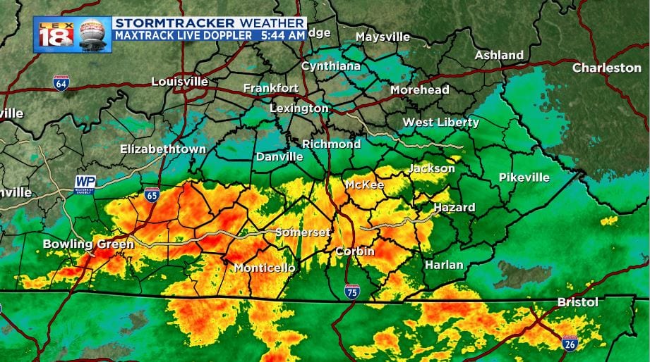
As we continue through the morning, the rain shield will move north and cover the state. Most of the day will consist of widespread light to moderate showers which will make things worse in the flooding department. Roads will be slippery and ponding is possible. All of the swollen rivers, streams, and creeks will continue to rise, causing more areal flooding.
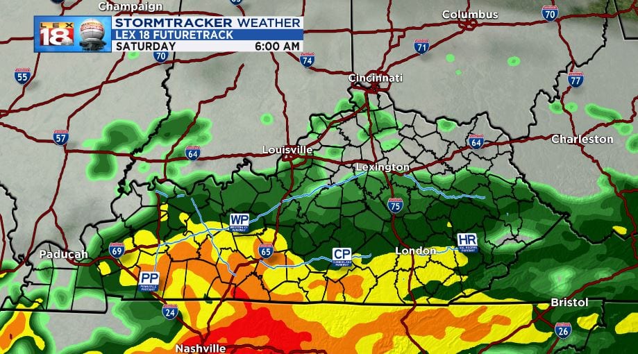
Later this evening, a cold front will track eastward and deliver a punch. A few single cell storms are possible ahead of the front, before a line of strong storms to deliver the cold front.

Main threats with the cells and squall line will be torrential rain leading to flash flooding, strong wind gusts and small to moderate hail. A few storms could be classified as severe. If a severe storm passes over your area, head indoors immediately. The strong wind and continued rain will have the possibility to down trees and power lines. Power outages are possible this evening.

The Storm Prediction Center is putting the central counties under a “Marginal” risk of severe weather this evening. A “Slight” risk is in effect for southwestern counties. Eastern Kentucky could see strong storms, but the potential for severe will be low.

Some of the stronger thunderstorms will consist of torrential rainfall which could cause flash flooding. A FLASH FLOOD WATCH is in effect and will be through early Sunday morning. The rain and storms will come to an end overnight and early tomorrow morning.

When it’s all said and done, we could pick up another inch in the Bluegrass near and over 2 inches in the south and southeastern counties.

At that point we start a dry pattern that will last most of next week. Water levels will have a good amount of time to lower in the coming fer ways. More information and your full StormTracker forecast can be found on our Weather Page
