A new project across the Great Plains rolled out this week with hopes of better understanding thunderstorms and the tornadoes they spawn. The goal of the project is improve forecasting of supercells, or spinning thunderstorms, and the hazards they can produce. Researchers will use drones along with a number of other tools to better understand how supercells unravel tornadoes.
Dozens of researchers from multiple academic institutions, lead by the University of Nebraska-Lincoln, along with federal government agencies are participating in the TORUS project (Targeted Observation by Radars and Unmanned Aircraft Systems of Supercells.) This project will cover 367,000-square-miles across the Central Plains from North Dakota to Texas and Iowa to Wyoming and Colorado.

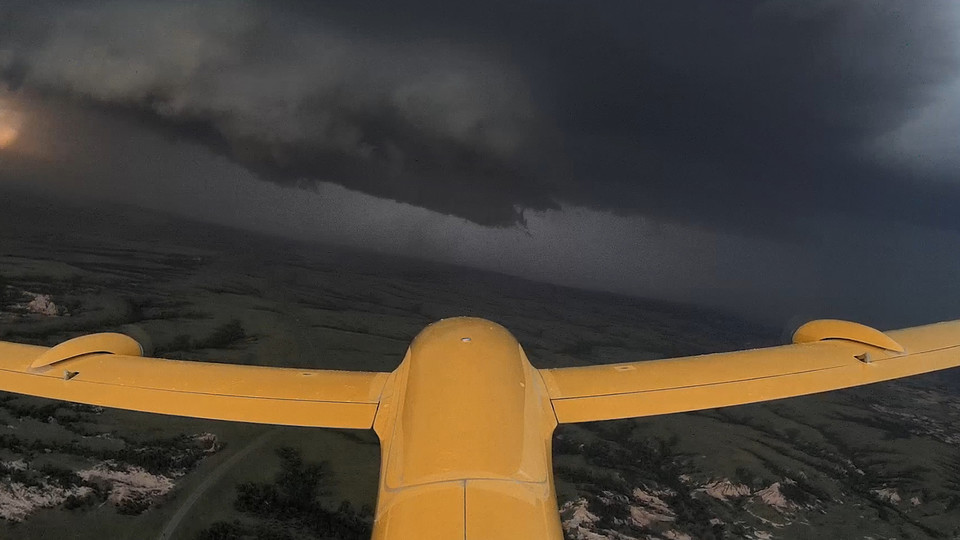
The TORUS project will use 20 tools to measure the atmosphere, including unmanned aircraft, mobile radars, radiosondes and weather balloon, and a NOAA’s WP-3D Orion “Hurricane Hunter” aircraft. These instruments will observe the frequency of changes in the atmosphere and the relationship between different boundary layers. Researchers are especially interested in wind speed, temperature, humidity, and air pressure. They seek to learn more about small-scale structures in supercells and how they contribute to tornadic formation.
Let the storm science begin! CU researchers today kick off a multi-university effort that will fly drones into supercells. #torus2019 https://t.co/jwBnjk1ToT pic.twitter.com/wWYP5LNHbt
— Julie Chiron (@chirony) May 14, 2019
TORUS follows in the footsteps of storm-chasing research projects like PECAN in 2015, the on-going VORTEX-SE in the Deep South, and the original VORTEX project which was also centered in the Plains.
The 50-some researchers will be out through June 16th. Another chase is planned for next year.
