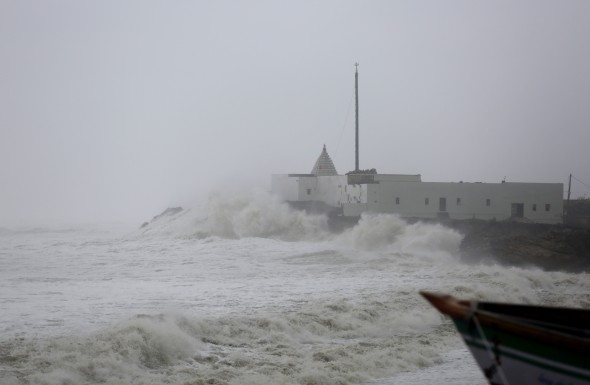
The western Indian state of Gujarat was bracing for the strongest cyclone in 20 years. Cyclone Vayu made a close pass to the coast Thursday but never made landfall. The storm was the equivalent of a Category 2 hurricane. Even without making landfall, parts of western India was still impacted by bands of heavy rain and strong winds.

Nearly 300,00 people were evacuated ahead of the storm. Power is out in 560 villages and tree damage was reported across the Gujarat state. Roundss of heavy rain will continue to fall from Mumbai to Diu along the west coat of India through the start of the weekend. Flash flooding may occur. The seas will also remain dangerous.
Vayu will reverse course and push back into northwestern India, and possibly Pakistan, into early next week. The cyclone is expected to be no stronger than the equivalent of a tropical depression. A weakened Vayu and another disturbance will spread spotty showers and thunderstorms from the coast to New Delhi, which is farther inland. Local downpours, lightning, damaging winds, and blowing dust are expected with this second wave. Vayu will also delay the onset of monsoon season for the region, which typically begins June 15th.

