“Pre-fall” has been a great change of pace. The past few days have featured cooler, drier, and less humid air. Unfortunately all good things must come to an end. August will get back to its summer ways this weekend. And looks like it will be sticking around for a while.

Over the next six to ten days, the Climate Prediction Center gives Kentucky a 75% chance of seeing above-average temperatures. Temperatures have already started warming back up. After two consecutive days in the 70s to near 80°, today we reached the low 80s. There will be another day with below-average highs tomorrow.

Three straight days with highs near 90 degrees will follow. Lexington has not recorded a 90 degree high since August 7th.
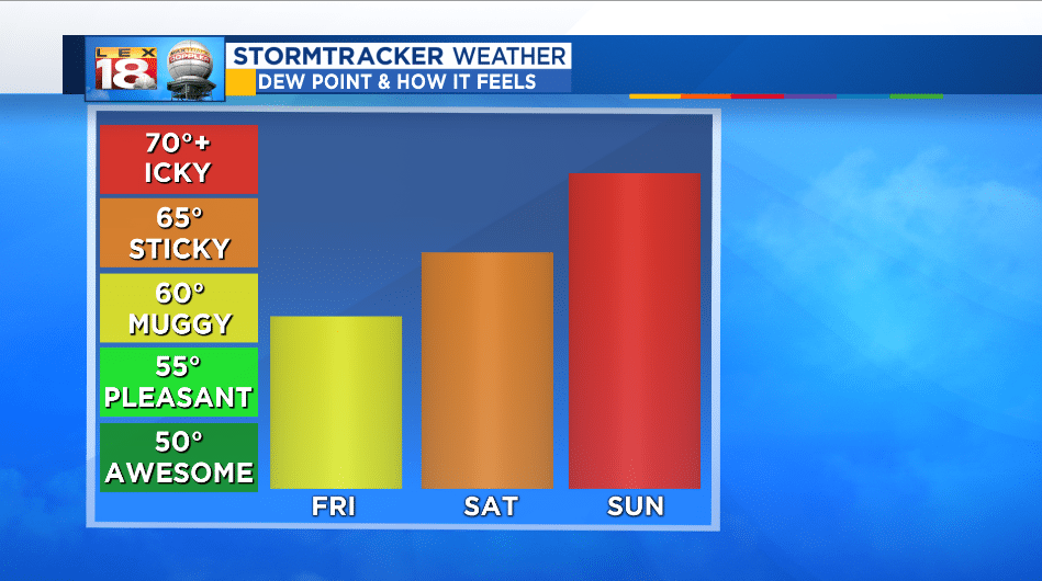
We are tracking a warm front to glide over the Bluegrass tonight. This set-up will usher back in the muggies, and also bring carry a small chance for showers and thundershowers Saturday morning across northern Kentucky. A few may dip as far south of I-64 through the early afternoon. By Sunday dew points will be registering “icky” on the muggy meter.
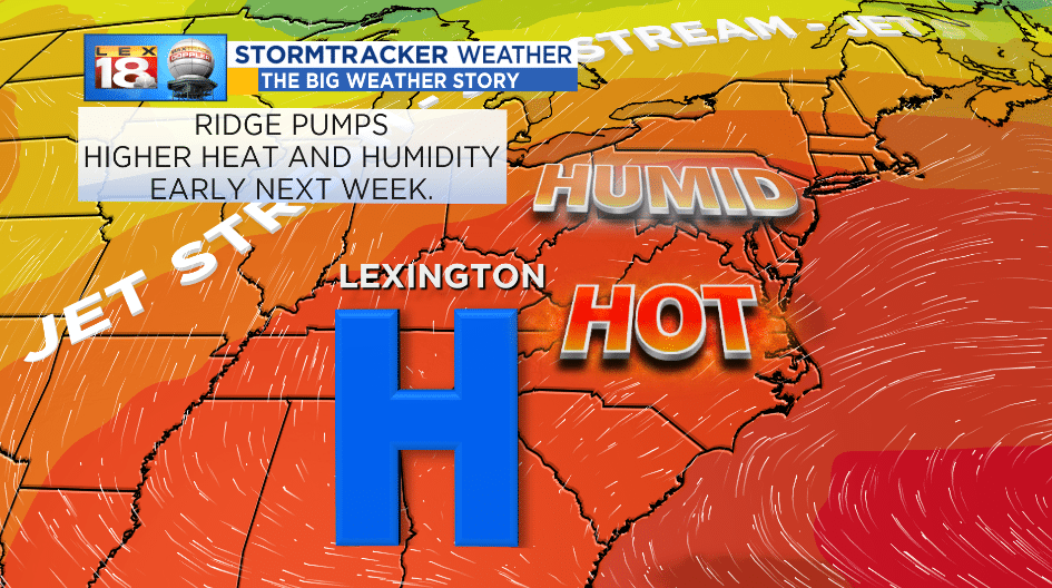
A strong ridge of high pressure will set up during the final days of August. This is the same high that ushered in the early fall-like conditions just a few days. The high will retrograde, or track westward, and intensify through early next week. The set-up will continue to pump more heat and humidity into the Bluegrass. The set-up is nicknamed the “ring of fire.” Thunderstorms can bubble up along the rim of the ridge. Some of those storms will start sneaking into the StormTracker Forecast on Wednesday.
