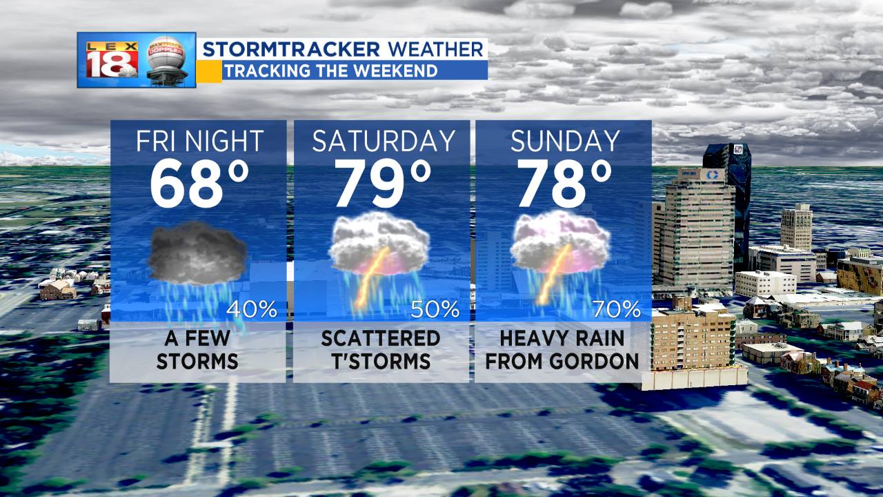
Here’s the good news – the weekend won’t be a total washout, and you won’t need to wash your car. However, we are tracking waves of heavy rain and storms through the weekend. Activity will be more scattered in nature this evening and throughout Saturday. If you need to get some outdoor work done, Saturday will be your day.
A stalled front will then pick up the remnants of Gordon on Sunday, spreading tropical downpours across the Ohio Valley in process. The axis of heaviest rain will remain across Indiana and Ohio with those areas receiving as much as four to five inches of rain through Monday. We are tracking one to three inches for central and eastern Kentucky. Higher amounts are expected north of I-64, where flash flooding will be more likely. With extensive cloud cover and persistent rain chances, highs will fall below average over the coming.Expect upper 70s to near 80 degrees through Monday. The rain and storms from Gordon will wrapping up during the first half of Monday.
Stay ahead of the weekend rain with the *free* LEX 18 StormTracker Weather app.