Lexington is up to its 22nd wettest October and 12th wettest year. These waterlogged numbers are a snapshot in time- we have more rain tracking our way Monday. But there is good news, a drier break in the pattern is brewing. Expect a cloudy & cool Monday with showers likely and morning temps in the 60s falling into the 50s as a cold front tracks east.
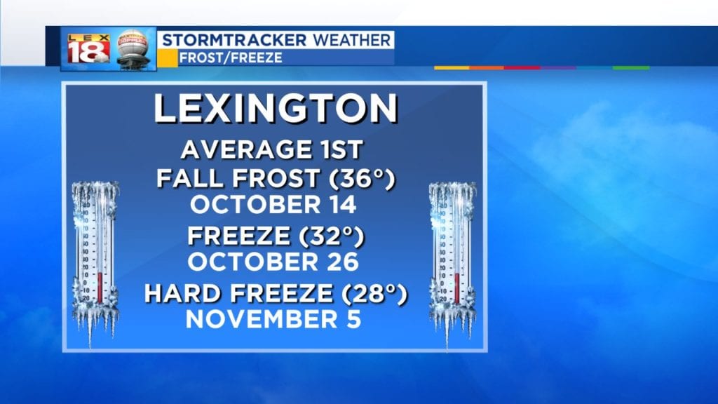
Behind that boundary, a few dry days as high pressure takes over. Tuesday through Thursday will be mostly to partly sunny and cool with highs in the 50s and colder overnight lows. Our first frost of the season is possible with lows in the low to mid 30s Thursday morning. Enjoy the break while you can! More rain is on the way this weekend.