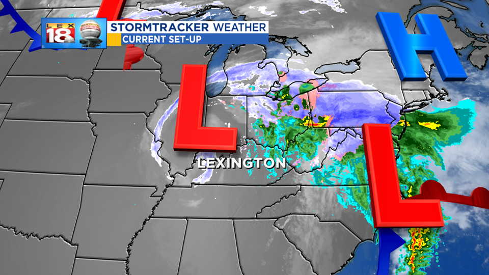
It’s not over yet. So far our first wintry system of the season has made things icy and very wet. Wrap around moisture and cold air will bring one final push. We are tracking scattered rain and snow showers to develop this afternoon/evening.
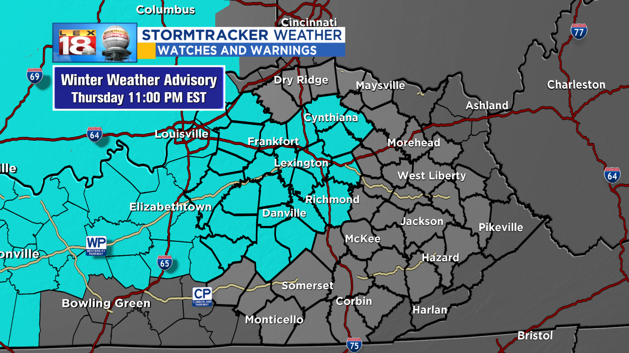
A Winter Weather Advisory is now in effect for central Kentucky until 11 PM. We are tracking a band of light to moderate snow to move through the Bluegrass during the evening commute. Minor accumulations, less than a half inch, are possible especially on elevated surfaces. Slick spots are likely to develop, especially on bridges and overpasses. These bursts of snow may also reduce visibility. Use caution on your way home. And for this reason, the LEX 18 StormTracker Threat Index has returned to a Level 1.
We are tracking these snow showers to wrap up after midnight. The Friday morning should be much smoother. Conditions will continue improving tomorrow ahead of a pretty nice looking, and feeling, weekend. There will be more sunshine and highs will be in the mid 40s to near 50°. And there’s more where that came from for Thanksgiving week.