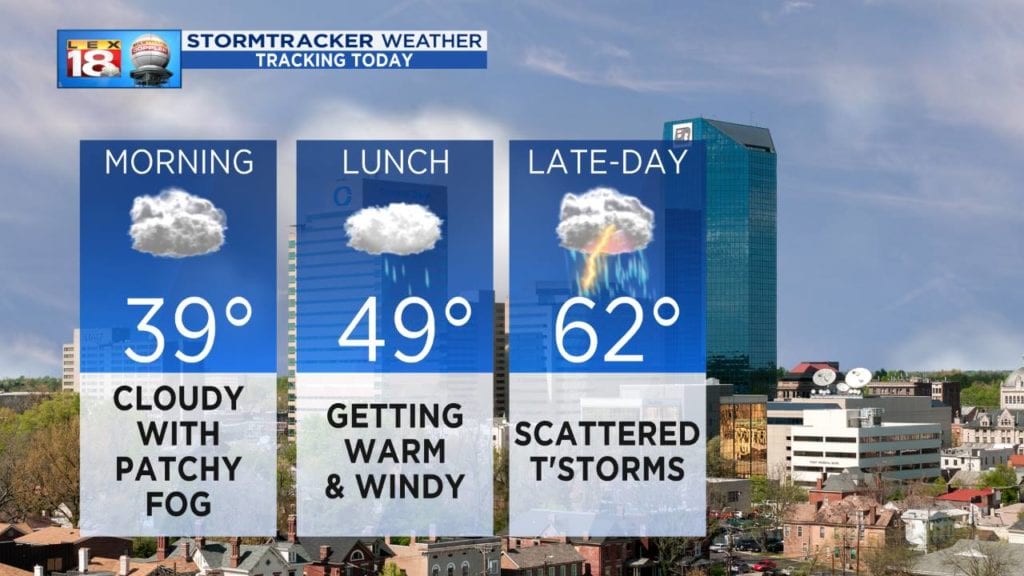
We are springing forward this weekend with the start of Daylight Saving Time, and so is our weather. A quick change from winter yesterday to spring today will come as a potent storm system moves through the middle of the country. The Northern Plains, Upper Midwest, and parts of the Great Lakes will get snow. There’s the potential for severe thunderstorms across the Mississippi and Tennessee valleys. For the Bluegrass, it will be a typical springtime day.
Temperatures will rocket into the low to mid 60s late-day as a southerly wind gets kicked up. We are tracking the potential for a few strong storms this afternoon and evening. Activity will come in waves during the second half of the day. It looks like storms will be diminishing in intensity as they move east. Still heavy rain and strong winds will be threats from some stronger storms. The rain and thunderstorms will exit as we go through the late night hours.
Sunday will be a nice day! Still windy, slightly cooler with highs in the mid to upper 60s, but there will be a good deal of sunshine. Next week will feature more spring, but don’t get used to it just wait. Another blast of winter is lurking over St. Patrick’s Day weekend.