This morning’s round of showers and storms is finally pulling out of eastern Kentucky. All-in-all this batch was more pesky than anything given the timing. Although there was a severe thunderstorm warning in Lincoln County, additional warned storms were outside the Louisville metro and across northern Kentucky.
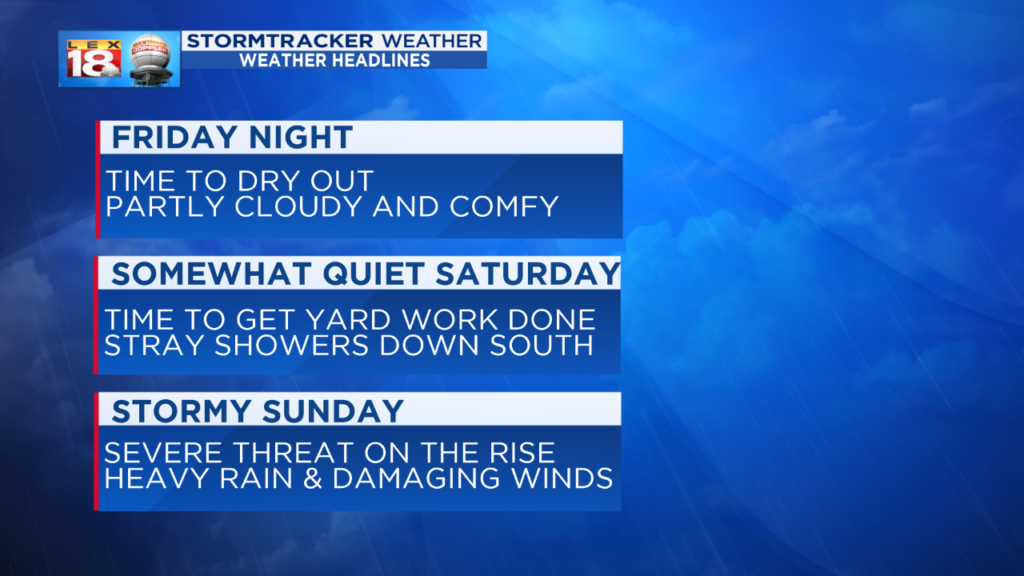
The unsettled weather won’t rest this weekend. Tonight and Saturday are looking good for the most part. This is the time in between storm systems. Skies will become partly cloudy overnight. We’ll keep bits of sunshine around Saturday with isolated shower chances for southern and southeastern Kentucky.
We will all get in on the action Sunday. A potent low will lift out of Texas and ride along the Mississippi and Ohio rivers. The severe threat is on the rise for the rounds of showers and thunderstorms expected to move through the Bluegrass and eastern Kentucky. Heavy rain and damaging winds are the primary threats, but all other storm threats are also on the table. We are closely watching the developments of this system. Stay with the StormTracker Weather Team throughout the weekend for the latest updates.