

THE LATEST: The National Weather Service has issued a WINTER STORM WARNING in effect for several central Kentucky counties, including Fayette, Bourbon, Nicholas, Jessamine and Clark.
The warning is in effect from Sunday 11:00 am until Monday 3:00 am.
A complex winter system is on the agenda for Kentucky this weekend. All types of precipitation with varying amounts are expected and things will change rapidly with this storm as Saturday progresses. Most of Saturday will be quiet in the weather story. Clouds will hang tough with a little clearing at times. Temperatures will suffer and remain around or a little above freezing. The low will drop southwest of us today and tonight bringing the bulk of the precipitation with it.
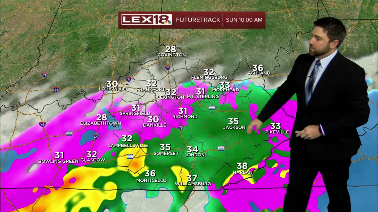
Timing will have multiple types of precipitation bubbling north into the state early Sunday morning. This swath of snow, sleet, freezing rain, and cold rain will continue to push north through the middle and late morning hours. As we continue into the latter part of the day Sunday, precipitation will begin to change over to all snow as the cold air behind this storm system works in. Snow will continue overnight into Monday morning with several additional waves of snow continuing through the day Monday.
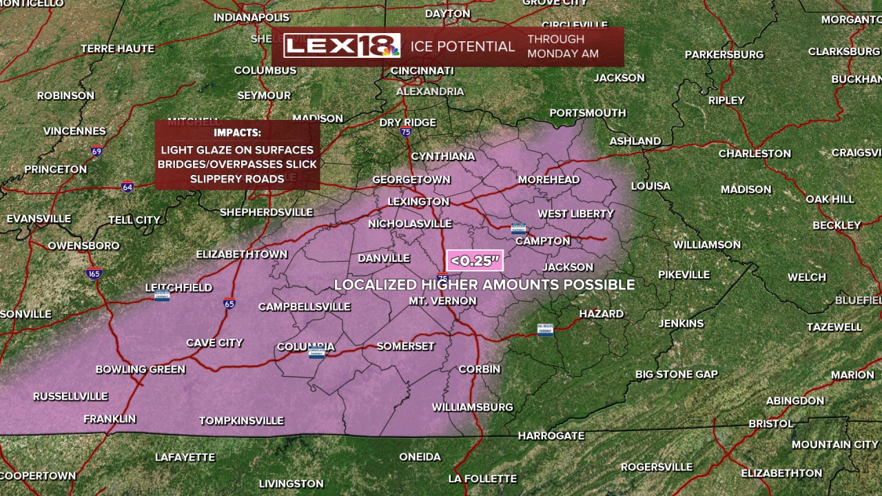
Warm air trapped between freezing air above and at the surface will aid in the development of freezing rain. The initial swath of moisture will include this intrusion of warm air above the surface. As the snow falls, it melts into rain, but refreezes as it touches the freezing surface. This puts a thin layer of ice on cold surfaces including bridges and overpasses. A light glazing of ice up to 0.25" is possible in these locations which could add more hazards to motorists.
Snow will be the dominant form of precipitation, especially late Sunday and Monday, and various amounts are expected. Generally, the further northwest you live, the less you can expect. However, most locations will get in the 3" to 6" range with higher amounts southeast around 8" to 10". As the low moves east, it will take the rain with it, but snow will continue through Sunday evening and into Monday. Best accumulation for snow will be later Sunday and into Monday morning. Keep in mind, this will be a wet snow so it will be heavy and able to stick to more surfaces than a dry snow might.

A WINTER STORM WATCH will be in effect from late Saturday through Monday morning. This is the time frame of expected road impacts. Slippery conditions are expected in all areas, regardless of precipitation type. You are encouraged to stay off roads at all costs, especially late Sunday. If you have to venture out Monday for work, expect delays on roadways and leave plenty of time to get to where you need to go. Give road crews plenty of space to work. Roads will be a mess until Monday afternoon at least. Above all, stay safe this weekend.

