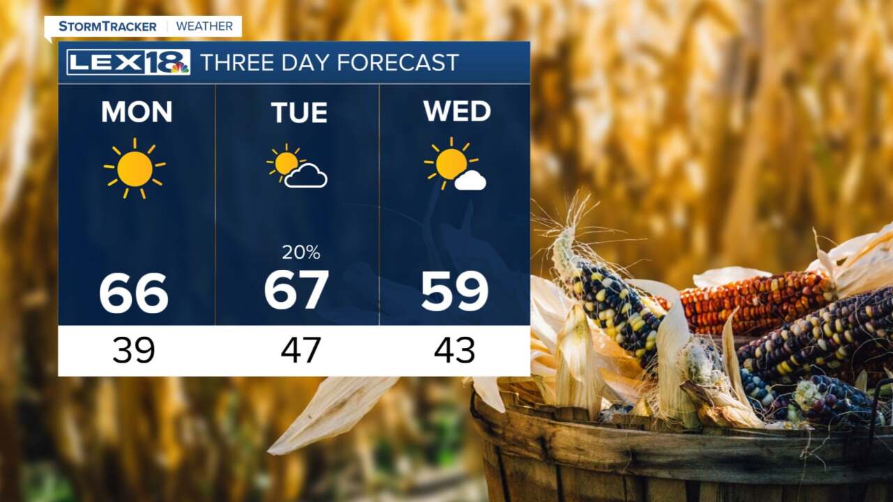


Now that the cold front has passed us, we are left with drying conditions for the remainder of the evening and into the night. Clouds will gradually clear and that will help our temperatures to drop off to the upper 30s. Patchy frost is possible in some low lying areas by early Monday, but the better chance for frost won't be until later in the week. Monday, and most of the week, will bring back the sunshine as we warm into the mid 60s. There's a small chance for a stray shower with a weak cold front set to arrive Tuesday otherwise we keep dry. Wednesday afternoon's highs may not get out of the 50s. Thursday and Friday mornings will be the coldest with low temperatures down well into the 30s, so those are the two mornings with most frost potential.
