


We are into our midweek and almost to the middle of January and a look back shows plenty of warmth has been sitting over us ever since the Siberian blast at Christmas. The entire year (we can accurately say) has been well above normal temperature-wise and even in rain amounts. We are in a surplus for the month and thus the year so far and we are looking at more rain set to arrive tonight and tomorrow.
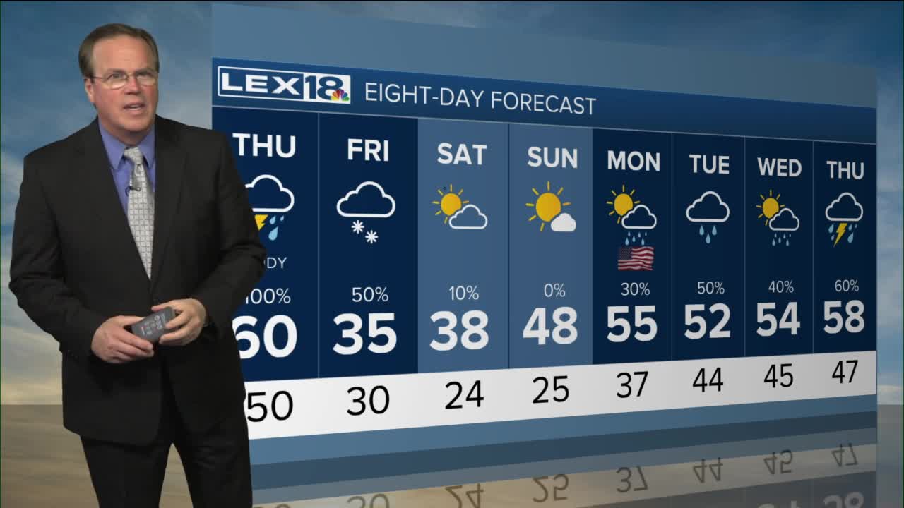
This system has been developing for the past couple of days and will move on it tonight. Until then, we can expect a few light rain showers through the evening and early night. Lows will only dip to the low 50s. Thursday will start on an active note as the storm system enters the Bluegrass. Heavy rain will be the case especially in the morning hours and a few thunderstorms with wind will blow through too. A marginal risk for severe storms exists tomorrow so that means we have a 5 to 8 percent chance of seeing a storm become strong or severe. The main threat will be strong winds. Rain totals will be between half an inch and one inch by Thursday evening.
After the cold front exits, we will see a small hit of winter. Colder air will settle in for a day or two and in those two days, any leftover moisture will fall in the form of snow showers Friday and Saturday. Accumulations, if any, look to be light. Once we are past the small round of winter, we warm right back up into the 50s next week.
