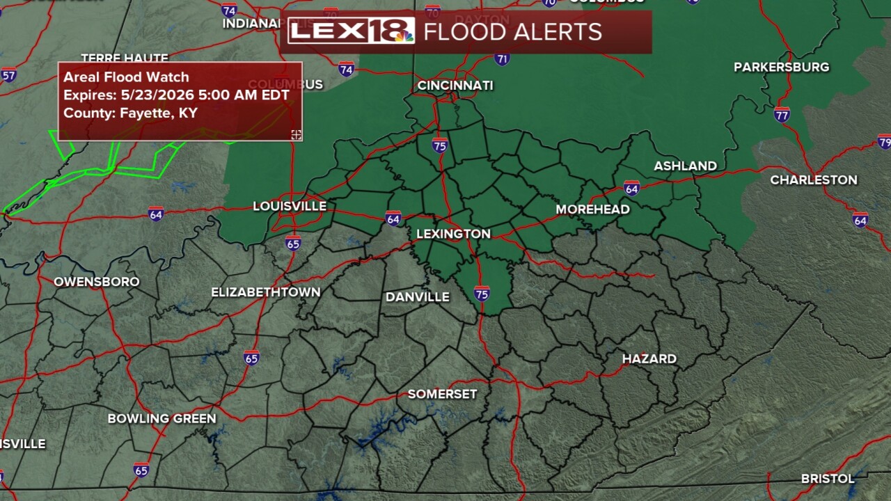


We are back to saying "what a wild ride of weather this week." We have gone from 90 degrees and dry on Monday to temperatures in the 60s with flooding possible today. A Flood Watch is in effect for Lexington and northern KY through early Saturday. Rain has been pretty steady through today and should continue into the night before tapering off, or at least becoming more spotty. Saturday will start with showers then we will dry out a bit for the afternoon and see some sun in between isolated showers. Between now and Saturday evening, we could see an additional half to one inch of rain.
Sunday looks to bring in more spotty rain/storm action as well. Temperatures will roll up into the mid to upper 70s Saturday and likely hit the low 80s on Sunday. As the frontal boundary hovers, more scattered showers and thunderstorms are possible on Memorial Day. Beyond the holiday, the weather pattern keeps on the unsettled trajectory with temperatures warming back up to the low and mid 80s keeping the summer feel in place.
