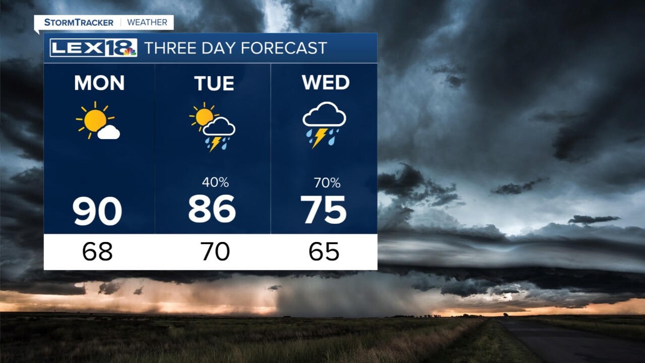


Our weekend is wrapping up on a very warm note as temperatures have risen into the upper 80s today. Tonight, we'll stay clear and dry. Monday will begin on a warm note, then the heat is on as high temperatures will climb toward 90 degrees in the afternoon. A couple of spots may hit the low 90s and the record high for Lexington is 92 degrees. By Tuesday, as the heat continues (mid/upper 80s), we will develop the chance for showers and thunderstorms. There is a strong cold front coming which may kick the severe potential up some on Tuesday. As of now, the main threats with strong storms Tuesday are wind and hail. Daily chances for rain and thunderstorms then continue for the rest of the week with a few disturbances rolling through the Commonwealth. You may not see rain every day, but there are good chances ahead. Temperatures will also fall back down to near normal except for a cool day on Thursday (mid 60s).
