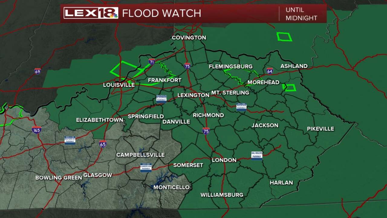


After one round of storms and heavy rain moving through northern KY this afternoon, a Flood Watch is issued and will stay put until midnight. A few Flood Warnings and Advisories are also in place. Never drive through a flooded road! Heavy showers along with a lot of lightning and thunder will continue to push through the Commonwealth through the evening and fade into the night. Friday is pretty much a copy/paste type weather day. High heat and humidity remain as do the showers and thunderstorms for the afternoon. Chances for rain will linger throughout the weekend, too. Over the next five days it is possible some folks will receive 2 to 3 inches of rain! Humidity levels will remain very strong as dewpoints hit the mid 70s so that is some sticky air. Next week looks just a touch drier, but that is also when our temperatures take off toward the low 90s again.
