


It's been a nice, sunny quiet day to get the errands run prior to the messy weather situation that lies ahead. Friday will bring one more dry day with some sun, but colder (highs in the upper 20s). By Friday night, the start of the precipitation will be upon us. Saturday morning (1 am) is when the Winter Storm Warning goes into effect and it covers nearly the whole state of Kentucky. We are looking at a very expansive system to cover multiple states and it will disrupt your life for a few to several days.
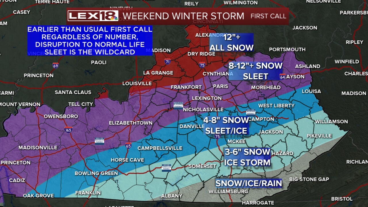
Snow will be heavy for central and northern KY. There might be some sleet mixing in at times, but this will mostly be snow. Lexington and areas along I-64 could see 8 to 12+ inches of snow. Northern KY will be all snow and will be around a foot or more. Central into southern KY, you'll see a little less snow and more sleet or even freezing rain. A potential ice storm may be the case for counties like Pulaski south and east. Snow will still be around southern KY (up to 6" possible). If rain falls on frozen surfaces, that will make freezing rain which is highly dangerous to travel on. Ice will likely cause power outages and downed tree limbs.
Regardless of totals, this is a huge storm and you need to be preparing NOW. Stay weather aware.
