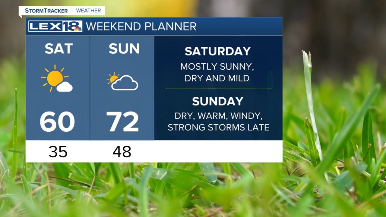


As we finish up another work week and head toward the weekend, we're tracking more big changes in the forecast. First of all, the wind will calm down tonight as the clouds start to clear. Temperatures will drop sharply to the mid 30s. Saturday will warm back up to around 60 degrees similar to today. The day looks dry with a mix of clouds and sun and much less wind. Sunday is the day we will have to watch. A strong cold front will move in from the west and it will kick winds back up again. The strong boundary plus wind and warmth will send energy our way which will lead to strong storms and heavy rain late Sunday night into early Monday. High winds will be the main concern, however, there is also a small tornado chance. Lexington will be in a slight risk (level 2) for severe weather. Beyond the front, temperatures tank again Monday and Tuesday with a few snow flakes possible.
