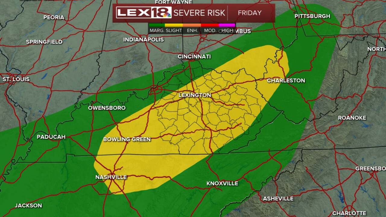


Rain from today was very needed and helpful, now as we move toward the evening and overnight stretch, we'll dry out with lows in the upper 50s. For Friday, we are watching another cold front that will move through. For the most part, Friday will be dry and warm (mid 80s), but that front will bring in an line from the west later in the afternoon/evening and some thunderstorms could become strong or severe. Much of the Commonwealth will be under a Slight Risk for severe storms including a low end (2%) tornado chance. Keep an eye on the sky tomorrow. Rain may also be heavy at times especially into the overnight/early Saturday morning. Saturday is looking to be a bit more on the gray/raw side as the backlash of the cold front comes through. High temperatures should only reach the upper 60s to low 70s! Sunday looks to be a better day with some more sun and a little warmer. Next week will return to a quiet, dry pattern with highs in the 70s.
