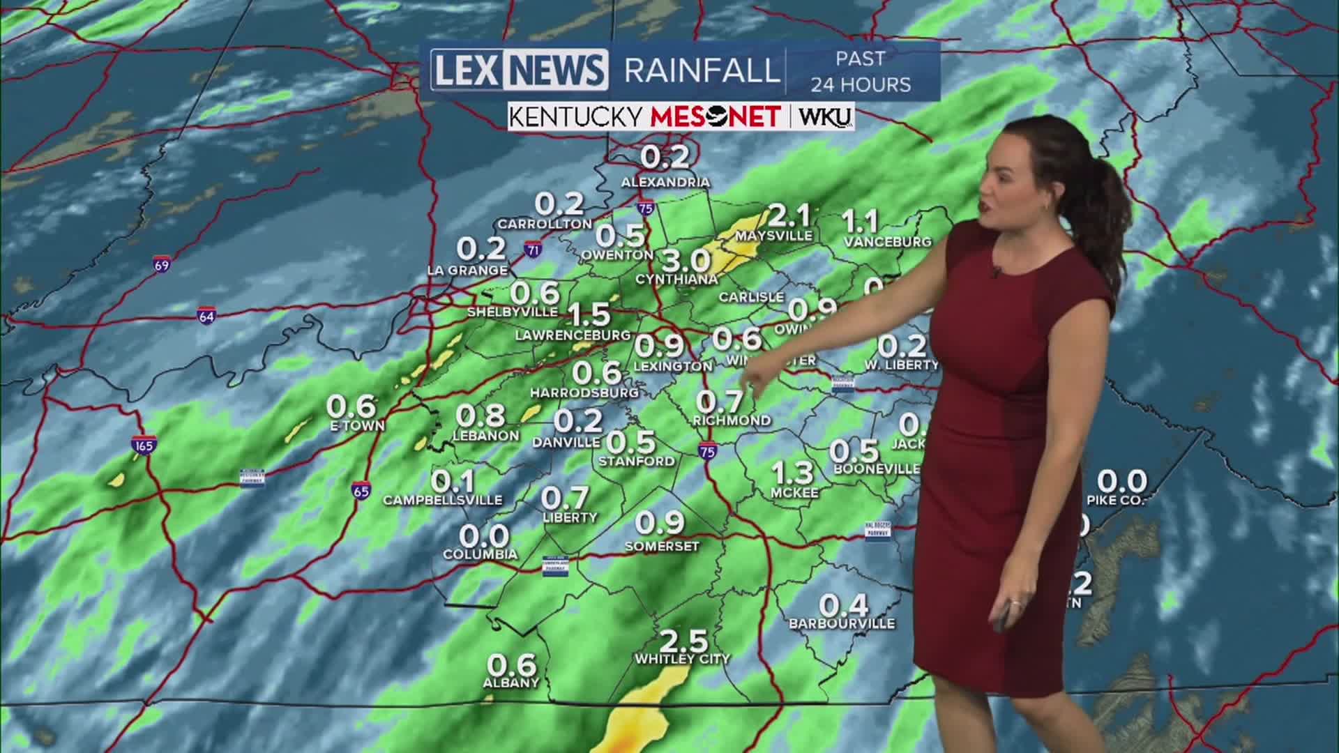


The holiday weekend continues with scattered heavy showers plus thunder and a few wind gusts. Much of the action will dwindle a bit moving into the night as we keep mild. If we see some sky clearing, that would spell patchy fog for Monday morning. Otherwise, the weather trend continues to remain cloudy, dreary and damp although Monday looks to be just a touch drier. Rain and storms will still be around, but I believe most of the rain to remain in southern KY. Afternoon temperatures should still push into the mid to upper 70s. Tuesday and Wednesday still hold scattered rain and storm chances with some heavy rain possible again. By Thursday, the action starts to fade and we will dry out for a bit as temperatures move into the low 80s.
Not as wet-looking for Memorial Day
Spottier showers will still be around
