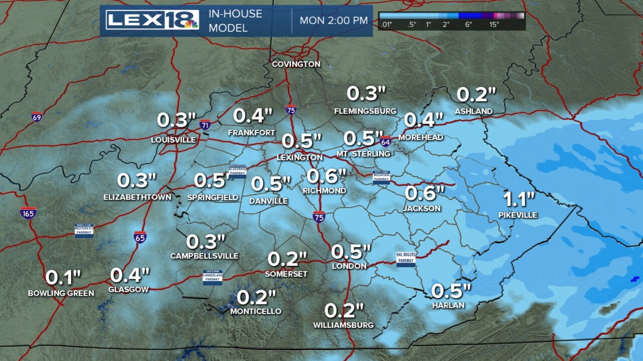


Our weekend is wrapping up on a nicer note than it started as we've been dry today and have seen high temperatures well into the 40s. This is the first day in the 40s this month, but now things change again. Tonight into Monday morning expect a few light snow showers to fall across the Bluegrass region and eastern KY. This will NOT be a big snow, but it will be cold enough to stick to roads and cause some minor travel issues or delays so plan accordingly. Totals will be between trace amounts and half an inch for most. Far eastern KY will have the better chance to see snow up around one inch or so. Once we get past this quick hit of winter, we might see some sun later on Monday but we keep cold and may not make it above freezing all day. A brief stretch of milder air is ahead for Tuesday and Wednesday before we see another temperature crash late week. This one looks to be the coldest we've see so far this season.
