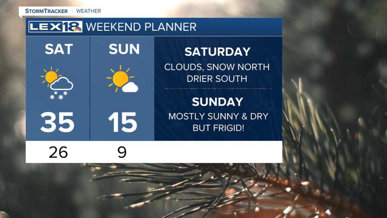


After an eventful and snowy start to our Friday, the wrap of our day is a bit different even though we have snow left on the ground. Temperatures tonight will support the re-freezing of anything that melted today so be aware of icy patches. For Saturday, much of the day is quiet, but another round of snow will work its way down from the north to south. This snow looks to be a bit less than today's, but it should still impact some of us. Snow totals look to be between 1 and 3 inches with one falling around Lexington and I-64, more to the north and less south. Southern KY might see a trace.
Any snow you see Saturday night will likely melt on Sunday with incoming sunshine. The bad news is that our high temperatures on Sunday won't make it out of the teens! Sunday night into Monday morning will bring lows in the single digits and wind chills as low as the negative single digits. It will be dangerously cold so take care of the pets and pipes now. Next week, we'll be right back in the 40s and 50s with thunderstorm chances on Thursday.
