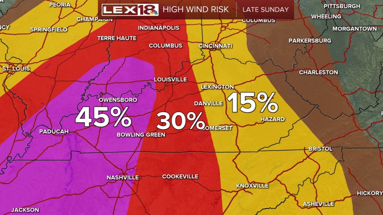


Our quiet weekend is about to turn much more active into tonight and last through early week. We have a strong cold front coming through tonight bringing rain, strong thunderstorms and wind with it. We already have seen some high wind gusts across the Commonwealth today, but winds within storms could be even stronger. A Wind Advisory remains in effect until 8 am Monday. This storm line also has the potential of spinning up an isolated tornado, though the greater risk is for western KY. What I think we will end up seeing tonight is damaging winds up to 60 mph or so. Rain will also accompany the front. Have a few ways of receiving warnings overnight. The timing for central KY will be between midnight and 3 am, and 2 am to 5 am for eastern KY.
Once we get past the severe storms, we will see an incredibly sharp drop in temperatures. We will go from the 70s today to the low 30s by Monday evening. The wind will still be around so that will bring wind chills back into the mix. It could feel as cold as the single digits early Tuesday morning! To add insult to injury, so to speak, we also have scattered snow showers through the day Monday. Accumulation will be very minimal if we see anything because the ground is so warm. It will feel like winter has returned through Tuesday, but we will warm back into the 60s and 70s by Thursday as we stay mainly dry.
