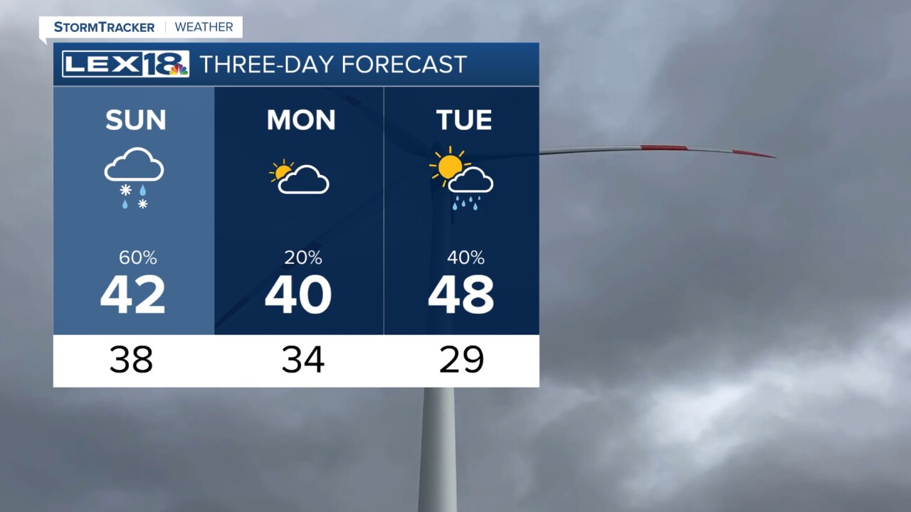


After several soggy and rainy days, we are finally starting to see the light at the end of the tunnel as drier days are on the horizon. Tonight, the low pressure that is bringing in all the moisture will continue to sweep through with several soaking rain showers and the possibility of a rumble of thunder as well. No severe thunderstorms are expected. Rain totals could roll up near 1 inch for some into the overnight stretch with temperatures falling to the upper 30s. For Sunday, most everything that falls will be rain, but as cooler air comes in on the back side of the low, we might see a light wintry mixing shower here and there. This could mean a snowflake or sleet pellet mixed in with rain, but it will not be a big deal nor lead to accumulation. Eventually, everything pushes out as the colder air settles in for early week. Monday looks mostly dry, but another quick round of rain is possible on Tuesday. The temperature trend will hang right around average for much of the next 8 days.
