The President's Day winter storm is ongoing and after the first round of wintry precipitation we saw wrap up earlier, we are left with the heavier stuff now. Just outside your window, you may be seeing some sleet (ice pellets), snow, or even freezing rain with the heaviest still expected for several more hours through this evening. At times, it may come a pretty good downpour of the sleet or freezing rain.
The Winter Storm Warning continues for areas north and west of Fayette county until 1 pm Tuesday. The Ice Storm Warning continues for Fayette county and south into southern KY as well as eastern KY until 1 pm Tuesday.
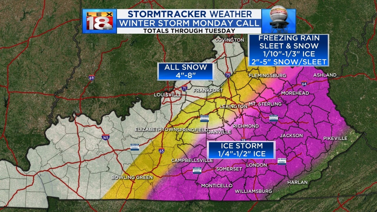
Keep in mind, there will be much mixing going on which continues to diminish the potential for snow accumulation. Northwest and western KY could still see 4" to 8" of all snow as that is where the coldest air aloft is sitting. A swath of area from Bowling Green up through Lexington and into northwestern KY near Flemingsburg is looking at more sleet than ice. Ice accumulations could still be up to a third of an inch with 2" to 5" of a sleet/snow mix on top of that. Then for southern and southeastern KY, it's looking like more freezing rain at this point where ice accumulations could reach half an inch in spots. We will also see an element of wind with what comes through this evening into tonight making the conditions even more harsh.
The bottom line is roads are getting bad and you need to stay at home if at all possible. Road crews need the space to get the roads treated and high traffic will make that much more difficult. Power outages are still a concern due to the fact that some locations will see ice on top of ice leftover from last week. All of the precipitation should be wrapping up quickly after midnight with only a chance for lingering snow flurries into Tuesday.


