


WATCH FACEBOOK LIVE FOR THE LATEST COVERAGE ON THE WINTER STORM.
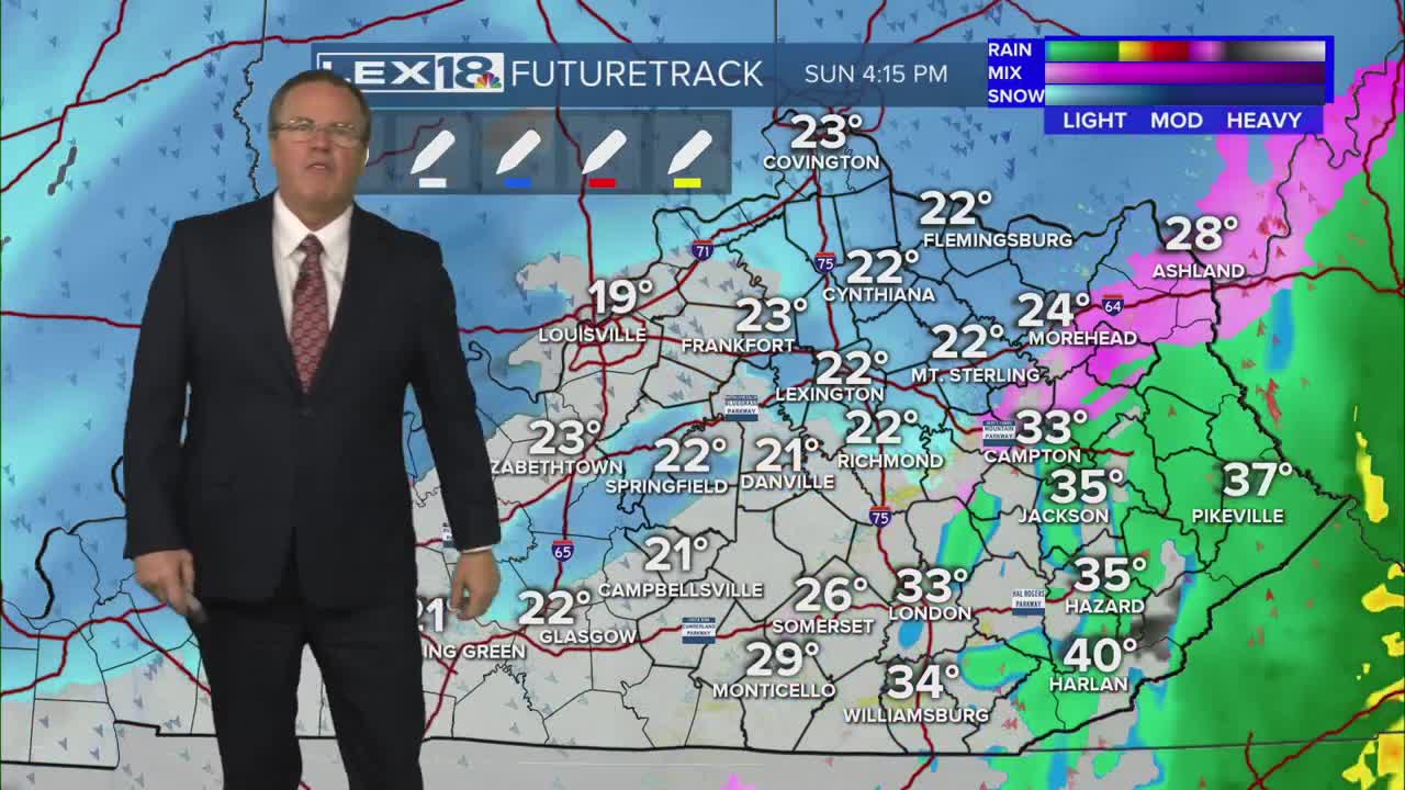
Our winter storm is upon us and things will likely intensify a bit overnight. We are still looking at heavy snow, some sleet, and freezing rain. The transition to sleet will begin in southern KY late tonight and inch northward throughout the day on Sunday. All of Sunday will be a mess as snow will change to sleet which will then change to freezing rain for many. The threat for an ice storm is growing for areas just south of Lexington and stretching down toward Somerset and London. As temperatures warm in southern and southeastern KY, they could see a shift to just plain cold rain for much of Sunday afternoon. All of the precipitation will wind down really early Monday morning as light snow.
The Winter Storm Warning remains in place until Monday 7 am. Travel will be hazardous to near impossible through Sunday. Temperatures will plummet post storm and stay well below freezing all next week. Wind chills will also be brutal as they drop to the negative double digits by Tuesday. The good news is that we will be more quiet and drier. Stay safe.
