Our rainy pattern continues as a stalled front sits over the Ohio River Valley. As of now, we’re mainly in a break between systems, but a few scattered showers are around. The next best chance for rain will arrive early tomorrow morning with moderate scattered showers and heavy clusters mixed in. Temperatures are still nice and mild, running in the mid 60s on the warm side of the front, and low 50s on the cool side.
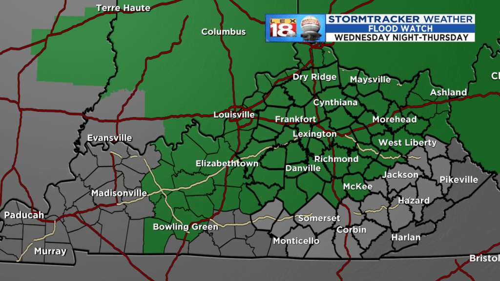
Rain will move back in tomorrow and we’re looking at a good amount through the last three days of the work week. Rainfall amounts look to range between 1” and 3” area-wide with up to 4”+ localized in some locations. Flooding is possible with this much rain in only a period of a few days. A FLOOD WATCH has been issued and will be in effect from Wednesday evening through Friday morning. Watch for high water, especially on roads during this time frame. Remember to NEVER drive through a flooded roadway.
Use caution as heavy rain may cause rapid water rises. Ponding on roads is likely and could make driving difficult. Thunderstorms are expected to be embedded inside the lines of heavy rain. If you hear thunder, head inside. Strong thunderstorm wind gusts are possible, especially Thursday afternoon. Due to strong southwesterly wind flow Wednesday and Thursday, the afternoon highs will be very close to and could break the daily high temperature records for both days. The previous record is 67 degrees both afternoons, set back in 1925. Immediately following the cold front, temperatures will cool rapidly. Friday will remain mostly in the 30s as colder air moves in.

