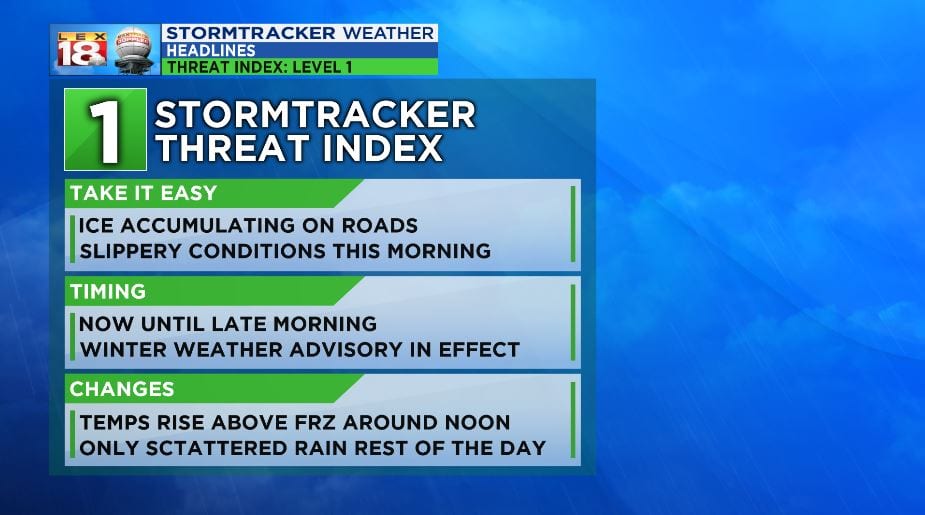
Road conditions have deteriorated due to light freezing drizzle this morning. Rain is falling into air that is below 32 degrees and turning to ice on contact with freezing surfaces. Windshields, sidewalks, bridges, and overpasses are the most affected. Your Sunday morning drive will likely be impacted through the late morning, if you live in the Bluegrass or eastern counties.

The WINTER WEATHER ADVISORY has been extended to include the Bluegrass in the minor ice event and will run until 11:00 am. Ice accumulations of less than 0.10” are expected and could cause hazardous roads. Once the temperature warms up above 32 degrees, precipitation will be only rain and ice will melt. Still, roads will continue to be slippery through the day, until the rain breaks overnight. Keep speeds low when traveling. Interstates and the parkways tend to see the most accidents as speeds are higher on these roads. Still, inner city and county roads will have the chance to ice over and accidents could occur. Stay off the roads this morning if you don’t need to be anywhere in particular.
The threat index for has been raised to a level ONE or SLIGHT for the remainder of Sunday morning.
More information and updates on the weather can be found at the LEX 18 StormTracker Weather Page
