Its amazing what a breezy southerly wind will do to our temperatures. We are up 15-20 degrees, despite the cloud coverage that has been abundant through the day. Temperatures boosted into the low to mid 60s for much of the region, and we’re not stopping there. Winds will be increasing this evening ahead of the winter storm moving in. Rain showers have a small chance through the day today, but better chances tomorrow.
We’re keeping an eye on the massive winter storm making its way through the central United States today. Wind will be a major component of this system, no matter what side you live on or what precipitation type you get. This massive storm wind mixed with the thunderstorms expected tomorrow could cause strong wind gusts through Thursday. The best chance for precipitation will start early Thursday morning. Don’t be alarmed if you hear a few rumbles of thunder in the morning showers, but the better chance for storms will come in the afternoon/evening. A midday “break” will include abundant cloud coverage, gusty winds, and a few light and scattered showers. As the main line of storms moves in, rain will get heavier and storms will be more abundant. Expect the usual with a few of theses storms. Heavy downpours, lightning, and strong wind gusts. Damaging straight-line winds are possible with a few storms which could push severe limits.
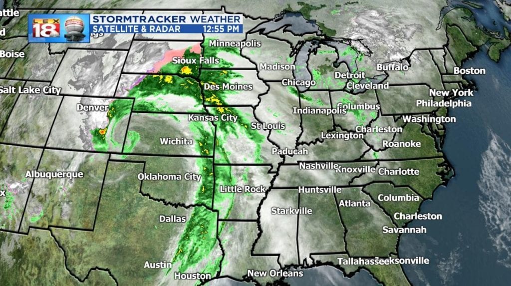
More information on the incoming system and what we can expect can be found on the LEX 18 StormTracker Weather Blog.
