

Sunday has been another nice one, and this time with less to worry about storm-wise. Mostly to partly sunny skies have prevailed with the only cumulus really showing to the southeast. The only spots dealing with pop-up storms are along the VA state line, where atmospheric pressure is lower.
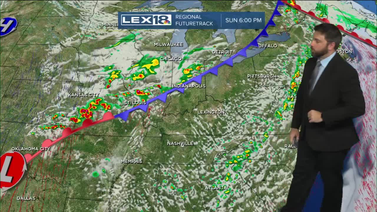
The second cold front of the weekend is still slated for tomorrow morning. This means that the rest of Sunday will go by without any interruption. Another plus to the forecast will be the timing of the front. Due to cooling temperatures overnight and the stable air in place, storm strength will not be as high as previously thought.
The SPC’s latest outlook map has the “marginal” risk only covering about half of the forecast area. The “slight” risk has been pushed west to only include Louisville and counties west. While this is good news, we still need to keep an eye on the forecast for Monday morning. Storms will still be able to produce damaging wind gusts and hail. Torrential rainfall and abundant lightning are also possible.
Timing will have the line of thunderstorms arriving in the early morning hours for the Bluegrass (~4:00am – 5:00am). The line will continue southeast through the mid-morning hours eventually leaving the state around midday. While the severe threat is lower, still have a way to get weather alerts just in case.
Temperatures will run cooler and around normal for your Monday afternoon. Sunshine returns in the afternoon and will continue for Tuesday with the next ridge of high pressure.
