
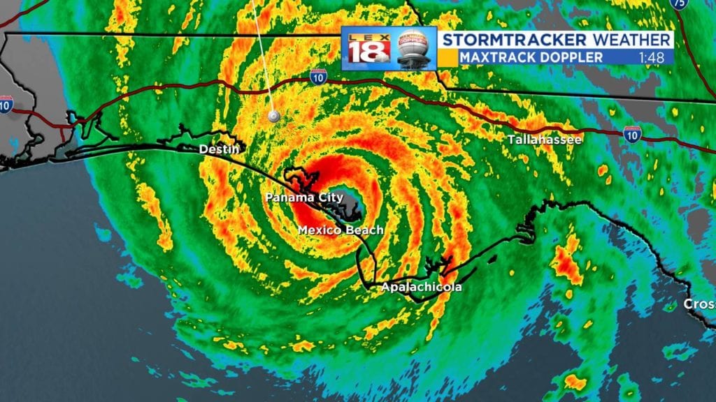
In terms of power every worst case scenario with Michael came to pass. It got down to an incredible 919 mb at landfall with winds of 155 mph east of Panama City near Mexico Beach. Destin did not see the worst, but still bad. Still not over by means.
Amazingly, Wikipedia has already updated their list of hurricane intensity. For the entire Atlantic Basin Michael will end up being tied for 19th on the all time list based on the central pressure of 919 mb which is just over 27″ on your home barometer (if it went that low!). In terms of pressure, this is lower than Andrew. The wind speed of 155 mph looks to be number 18 in the Atlantic Basin. What’s maddeningly frustrating is there is no nice easy clean cut list from the National Hurricane Center showing these records. It’s a whole lot of google searches piecing together information.
The European model did a good job with this system, but even it missed the final intensity. It’s amazing to go from a TD Sunday morning to a top end 4 (low end 5?) midday today. A perfect low shear environment and a lot of hurricane food makes for a tremendous atmospheric heat engine.
After the storm’s passage it’s safe to guess the pictures will be chilling tomorrow. It will be a while before normalcy returns to that part of Florida.
More later…
Bill
