
Tonight’s title actually has a double meaning. We’re talking about the return of winter AND the return of the MaxTrack LIVE Doppler radar.
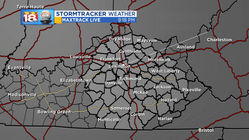
You can see the sweep line again emanating from Lexington’s northside as central Kentucky’s first full power Live radar returns to duty scanning the sky. It had been down since the early part of December as 1 critical piece (the pedastal that allows it to spin) broke down. What is terrific about our management at WLEX and our long time owners (but not for much longer) Cordillera Broadcasting is they recognize the importance of a LIVE radar in providing the most accurate and critical weather information possible. The decision was made immediately to make the repairs, and not let it sit as a giant paperweight in our backyard. The reason for the delay of a month is unfortunately you can’t just go down to Radars ‘R’ Us and grab the parts. They had to be ordered and this week was the first time we could get a technician from Baron (the company that manufactured it) into fix it.
Fortunately, we did not have any severe weather to contend with when minutes and seconds can count during our very wet December, but we still had access, and used, the National Weather Service’s NEXRAD Dopplers. They aren’t live, and we didn’t show their sweeps (or use the term live) during the outage, but for the type of weather we experienced they were more than adequate.
It’s hard to believe that the MaxTrack will be turning 16 years old this year (hey it can drive!). When the station made that commitment more than a decade ago, there was nothing like it here. If you’ll pardon the pun, it’s weathered many storms around the Bluegrass and performed to perfection. From the Masterson Station Tornado in 2004 (when it paid for itself providing the only radar data on that tornado), to the horrific tornadoes of March 2, 2012 and everything in between, it continues to scan the sky helping us to pinpoint the most dangerous areas and get folks information in a timely and useful manner. There is no other radar like it around. I was speaking with the Baron tech today and we were talking about this model of radar. To quote him, “It’s the most reliable radar we’ve ever made.” There are others that may be flashier, but for reliability and dependabilty this is the one to have. We’ve basically got the Camry of radar. It’s solid, dependable and gets you from point A to B for a long time. Hopefully we’ll never need its capabilities, but it’s nice to know they’re there if and when severe weather returns.

I think I just wrote a 450 word love letter to our radar…not that there’s anything wrong with that.
Now onto part 2 of They’re Baaaa-aaack…the return of winter. We enjoyed another remarkable pre-spring day with a high of 66 which was 5 degrees shy of the record of 71 from way back in 1937. It was also a very windy day with gusts going from 40 to 50 miles per hour for a while late today. Well, in the immortal lyrics (more or less) of the Mickey Mouse Club, “Now it’s time to say good-bye to all that springtime warmth…”
An initial push of chillier air arrived in the Bluegrass about 4:00 today and started knocking the temperature back. It’s still above normal air, but it’s also short-lived. A secondary cold front will come through before dawn and knock the temperatures down into the upper 20s. As cold Canadian air spills in…actually it looks like it may be modified Arctic air as it will be very dry…the thermometer bascially flat lines tomorrow with highs just in the mid 30’s. There’s a lot of bare ground between us and Canada, so the air mass has a chance to moderate to readings that are 5 to 10 degrees below seasonal average, which isn’t anything drastic for January aside from the fact that it will be 30 degrees colder than today. It will also be a dry high through the rest of the week.
Now we do continue to look at storm threat for the weekend. As we’ve talked about in previous entries the last couple of days, the low isn’t in the data rich environment yet, so our computer modeling, which is guidance and not gospel, is still bouncing around on the potential. The big beautiful low we showed yesterday in the Pacific has begun the process of splitting around the upper ridge going up the west side of the continent (more on that in a minute).

So those lows will arrive on the West Coast tomorrow and we’ll be getting a much better read as to what these guys are made of which will allow us to begin to hone in on details for this weekend. Yesterday we talked about when these 2 would reconnect, or phase. Today they were leaning to a more westward solution for that point, which is a slightly colder scenario for us overall. However, with the lack of snow cover to the north, don’t be surprised at all if the primary rain/snow line which on today’s runs was cutting Kentucky in half will be drifting north as we get closer to the event this weekend. We’ll certainly continue to be advertising a very ‘interesting’ system this weekend, but there is also a very real possibility that it’s a good percentage of cold rain. We’re talking Saturday/Sunday, so still lots of time for details.
One other note tonight. Last Friday we showed how the jet stream helps keep a balance in the atmosphere. We’ve got a positive PNA setting up with a ridge going up the west side of the continent toward Alaska where it has been barbarically cold (good rule of thumb, Alaksa warm compared to normal, we’re cold and vice versa) while we’ve been warm.
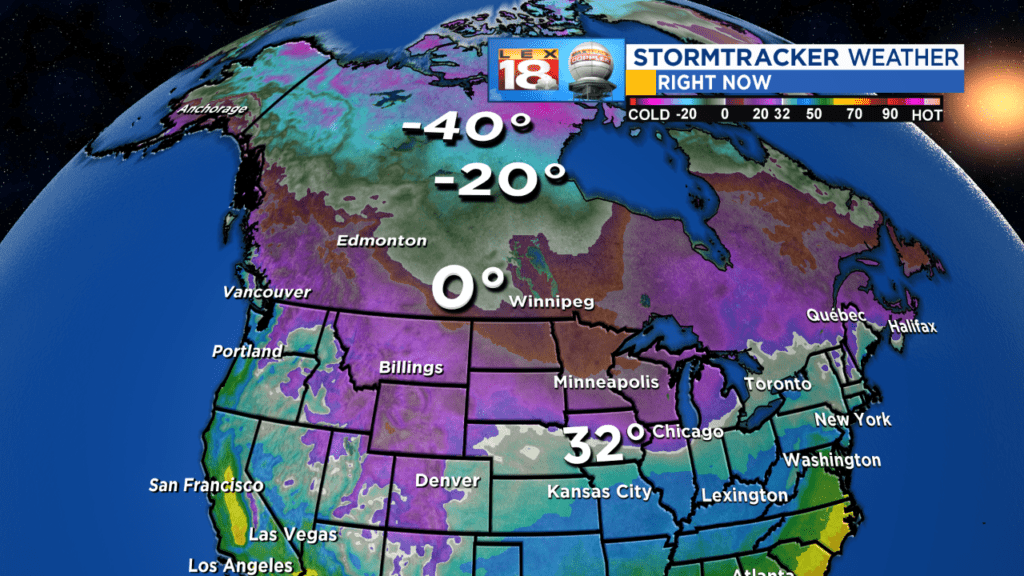
It’s not Siberian air, but it’s pretty doggone cold even for them across northern Alaska and Canada with temperatues in the pink being -40 and below. At this point we’re not dislodging that motherlode of cold, but some pieces of it will be heading our way over the coming days and weeks. The mechansim to bring it this far south isn’t on the field yet, but knowing that it’s lurking up there gives us reasons to keep looking north over the coming weeks.
Hopefully you’ve enjoyed the reprieve from huge heating bills. As we head to the mid point of meteorological winter next week, the second half of the season may end up quite differently than the first.
All the best…
Bill
