

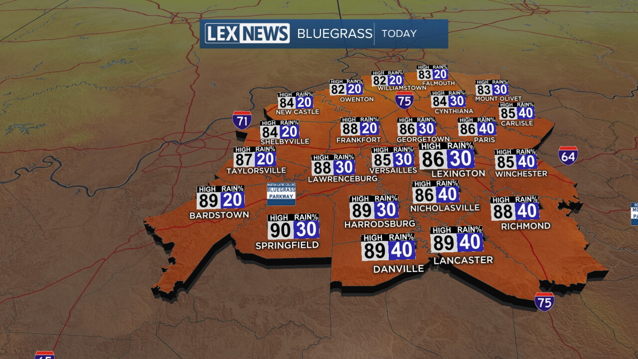
Our late summer heat wave peaked over the weekend with highs in the 90s. This week will bring significantly cooler changes, just as fall begins Tuesday. Expect partly to mostly cloudy skies with highs in the mid to upper 80s with a few late day showers and storms. That front will slowly sag south overnight, sparking a few more showers and storms. As the wind shifts over to the northeast, the cooldown begins with highs in the mid 70s Tuesday and a few lingering showers and storms early. High pressure takes over and sunshine returns with very pleasant weather later this week and highs in the low to mid 70s.
A Few Showers and Storms Start the Work Week
Much Cooler Air Inbound as Fall Begins
weather


Posted
 Facebook
  TikTok
  YouTube
 Instagram
 Threads
 X
XCopyright 2026 Scripps Media, Inc. All rights reserved. This material may not be published, broadcast, rewritten, or redistributed.
