
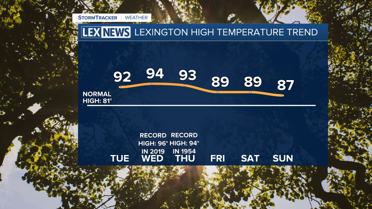


Here comes the heat! High pressure slides east Tuesday, and the wind shifts to the from the southeast to the southwest. This will surge warmer, muggier air across the Commonwealth with highs in the low to mid 90s through midweek. Lexington's record highs Wednesday and Thursday are in the mid 90s and we'll challenge them. Higher humidity will send the heat index into the upper 90s, pushing triple digits. A heat advisory is in effect for western counties until Wednesday evening.

