

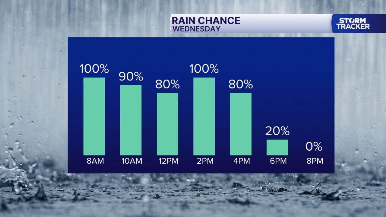
Our most substantial round of rain in weeks will soak the Commonwealth Wednesday with widespread rain and occasional rumbles of thunder. Rainfall totals will range from under 1" east to 1" to 2"+ west. With as dry as it's been, we should handle this without flash flood concerns, but isolated, localized flooding is possible where multiple bursts of heavier rain occur. With extensive cloud cover and a cold front tracking east we'll back away from Tuesday's record high in the upper 70s and fall to around 70° Wednesday then continue to dry out and cool down the rest of the week.
A Wet Wednesday Inbound
Widespread Showers and Storms Followed by a Cool Down Later this Week
weather


Posted
 Facebook
 TikTok
 YouTube
 Instagram
 Threads
 X
Copyright 2026 Scripps Media, Inc. All rights reserved. This material may not be published, broadcast, rewritten, or redistributed.
