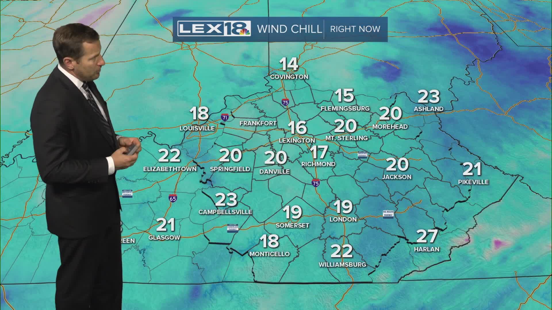


Stay weather aware Monday! Our coldest air and first snow of the season will have it feeling more like the middle of winter instead of fall. Expect scattered snow showers Monday, stronger snow squalls in the afternoon could lead to minor/light accumulation mainly on grass and elevated surfaces. A winter weather advisory is in effect until Tuesday morning. Between bursts of snow and gusty wind watch for briefly low visibility and use caution on the roads. Highs will struggle to reach the low to mid 30s and a gusty west/northwest wind will keep the wind chill in the upper teens to low 20s at times. Lexington's record lowest maximum temperature (low high) Monday is 29°. We're in for another hard freeze Tuesday morning with lows in the low to mid 20s. Sunshine returns Tuesday but Veterans Day will be chilly, highs will only reach the low to mid 40s. We'll rapidly warm back into the 50s and 60s later this week.
