

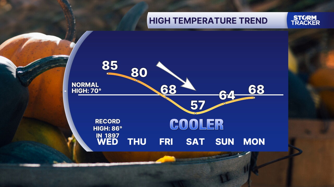
Lexington set a new record high Tuesday, and we just might do it again Wednesday. The only limiting factor, increasing clouds and late day showers and storms. Expect highs in the mid 80s Wednesday with partly to mostly cloudy skies. Showers and storms will develop by late afternoon and should be widespread into the evening. This will be a beneficial round of rain, but we'll also need to watch for strong storms with gusty wind and locally heavy rain. Showers linger Thursday before a cold front tracks through Friday sparking more showers and ushering in the coldest air of the season so far. Highs will tumble to the upper 50s Saturday with lows in the mid to upper 30s bringing out first chance for frost Saturday and Sunday morning.
Another Record High Possible Wednesday
But Showers, Storms and Much Cooler Air on the Way
weather


Posted
 Facebook
  TikTok
  YouTube
 Instagram
 Threads
 X
XCopyright 2026 Scripps Media, Inc. All rights reserved. This material may not be published, broadcast, rewritten, or redistributed.
