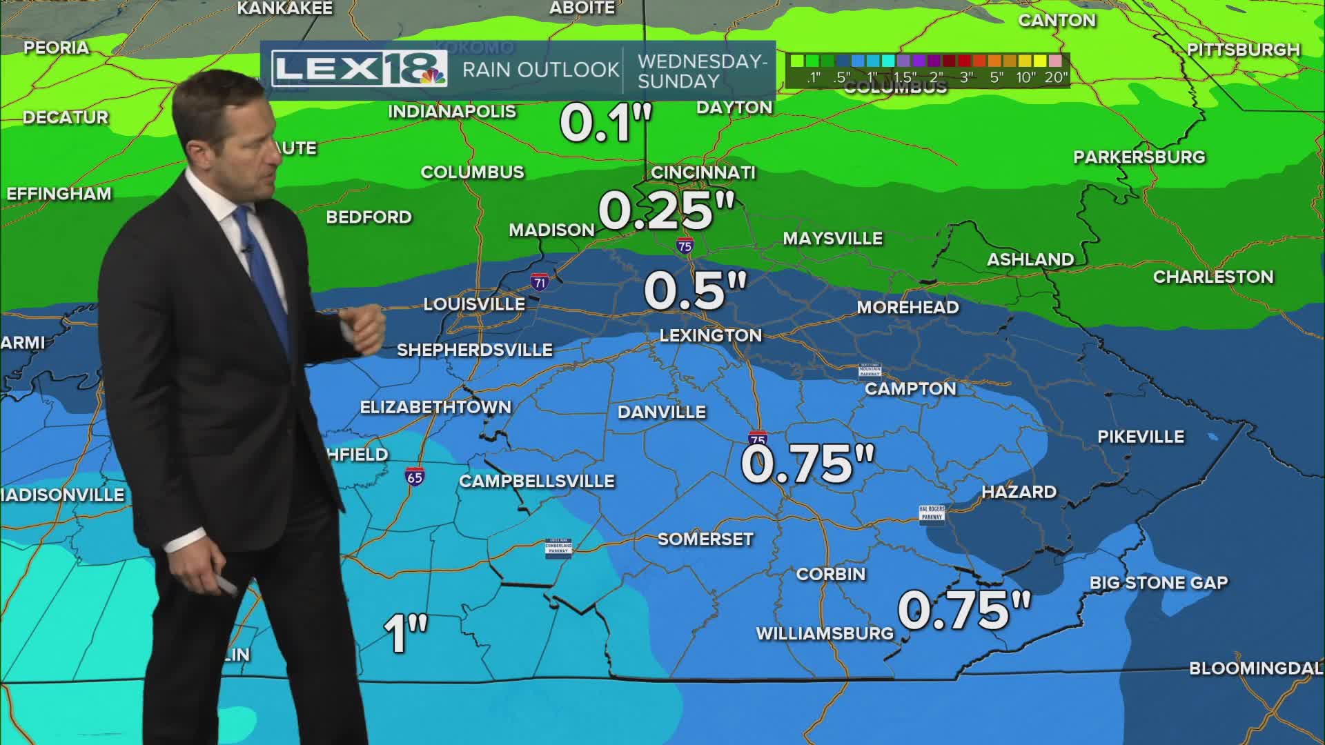


After soaring well into the 60s Tuesday and a round of overnight rain showers we'll end up partly sunny and closer to normal Wednesday with chillier highs in the mid to upper 40s. High pressure building in from out west will keep a north/northwest wind flowing and the temperature tamped down Thursday, even with mostly sunny skies we'll only reach the low to mid 40s. Highs edge into the 50s this weekend with increasing clouds and a rising rain chance Sunday. Presidents Day should dry out with highs still in the 50s early next week.
