


WATCH: Tom Ackerman was live on Facebook Friday morning with the latest update on the incoming winter storm:
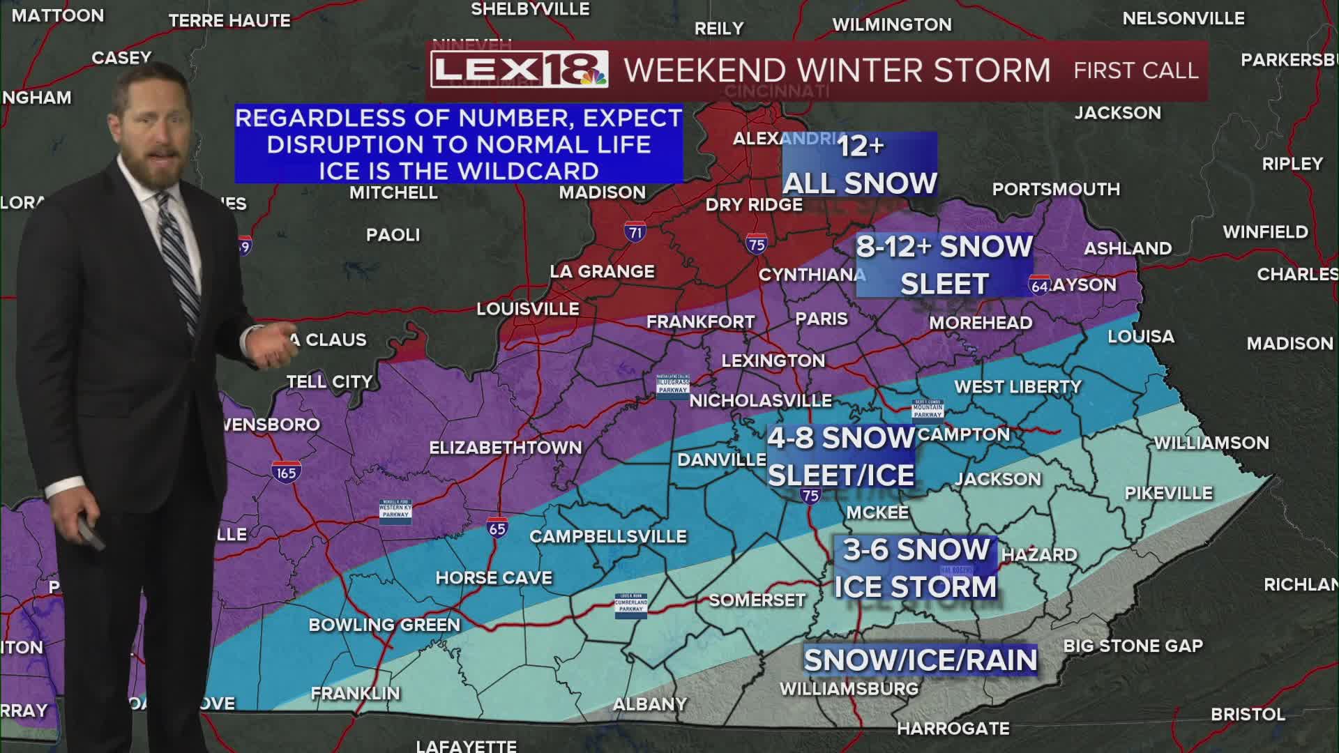
Friday is the calm before the major winter storm that's bearing down on us this weekend. This is the time to prepare and stay weather aware! We'll end up mostly cloudy with highs in the upper 20s in the Bluegrass and low to mid 30s southeast. Arctic air filters in throughout the day on a northerly breeze and we'll drop to the upper single digits overnight with a subzero wind chill. The first round of snow arrives Saturday, mainly in the afternoon with highs in the upper teens to low 20s. Another surge of moisture develops Saturday night into Sunday as low pressure tracks northeast. We'll see everything from moderate to heavy snow in the Bluegrass and northern Kentucky to a mix of snow, sleet and freezing rain as you head south. Expect an absolute mess on the roads, travel will become hazardous if not impossible late in the weekend and with highs likely staying below freezing next week it will be difficult to get rid of and deal with. It will also stay bitterly cold with lows dropping below zero a couple of nights. A winter storm warning is in effect Saturday morning through Monday morning. Snowfall totals will range from over 12" north to lower amounts south due to sleet and freezing rain.
