



Monday has brought some great weather across Central and Eastern Kentucky, with lots of sunshine, lower humidity and noticeably cooler temperatures. Afternoon highs have only reached the upper 70s and low 80s for many of us, finally giving us a little relief from the recent heat.
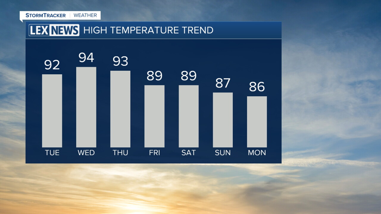
Unfortunately, that relief will be short-lived. A major warm-up begins Tuesday, kicking off several days of unseasonably hot weather with highs returning to the 90s.
One More Comfortable Night
We'll hold onto the comfortable conditions through tonight with mostly clear skies and relatively low humidity.
Temperatures will fall into the mid and upper 50s across portions of the Bluegrass, while areas farther south and west stay a little warmer in the low to mid 60s.
Winds will gradually shift overnight as warmer air begins working back into the region, setting the stage for a dramatic temperature jump Tuesday.
Temperatures Jump More Than 10 Degrees Tuesday
Tuesday will feel completely different compared to Monday.
Afternoon highs will quickly climb into the low to mid 90s, more than 10 degrees warmer for some locations. Humidity will also make a comeback, pushing heat index values into the mid 90s to low 100s during the afternoon.
Most of the area will remain dry with plenty of sunshine. A stray shower will be possible, mainly west of I-65 and across Southern Indiana, but widespread rain is not expected.
Heat Sticks Around Through Midweek
Wednesday and Thursday will bring more of the same as a strong ridge of high pressure builds over the region.
Highs are expected to reach the mid 90s both days, with some locations potentially climbing into the upper 90s. Heat index values will once again reach the upper 90s and low 100s during the hottest part of the afternoon.
Overnight temperatures will also become much warmer, with lows only falling into the low to mid 70s. That limited overnight relief combined with several consecutive hot afternoons could make this late-season heat especially noticeable.
Make sure to stay hydrated, limit extended time outdoors during the hottest part of the day.
Mostly Dry With Only Isolated Rain Chances
Despite the increasing heat and humidity, rain chances will remain fairly limited through much of the week.
High pressure will suppress most shower and thunderstorm development, especially Tuesday and Wednesday. By Friday and into the weekend, isolated showers and thunderstorms could begin popping back up, but rain chances currently remain low.
That means many communities could go several more days without seeing meaningful rainfall.
