



After another chilly start Monday morning, temperatures have rebounded nicely across Central and Eastern Kentucky. Plenty of sunshine has helped us climb into the low to mid 70s this afternoon, giving us another beautiful fall day.
The quiet weather isn't going anywhere anytime soon. Clear skies and dry conditions will continue through tonight and Tuesday before temperatures begin warming later this week.
Another chilly night ahead
We'll remain clear and dry through the rest of Monday evening, allowing temperatures to fall quickly after sunset.
Most locations will drop into the mid to upper 40s overnight, with lower 40s possible across portions of Eastern Kentucky. Some of our coldest, sheltered valleys could even briefly dip into the upper 30s by early Tuesday morning.
Despite those chilly temperatures, the chance for frost remains very low and would be extremely isolated.
Another beautiful fall day Tuesday
Tuesday will essentially be a copy and paste of Monday.
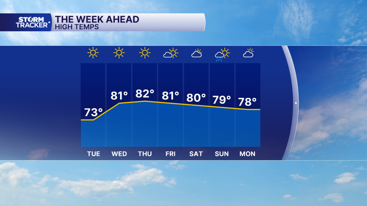
We'll see lots of sunshine with dry conditions sticking around throughout the day. Afternoon temperatures will once again reach the low to mid 70s, making for another comfortable fall afternoon.
Tuesday night won't be quite as chilly for most of us, with lows generally falling into the mid to upper 40s.
Temperatures climb into the 80s
We'll start warming things up Wednesday as winds shift and begin bringing warmer air back into the region.
Highs will climb into the low to mid 80s Wednesday and remain above average through the end of the workweek. Despite the warmer afternoons, humidity will remain fairly low, so it should still feel relatively comfortable outside.
Lots of sunshine and dry weather will stick with us Wednesday through Friday.
Rain chances return this weekend
Our next opportunity for rain arrives late Saturday into Sunday as moisture begins pushing north into the region.
Rain chances currently sit around 40% to 60%, with the potential for some beneficial rainfall after another mostly dry week. Some areas across Southern Kentucky could potentially pick up around an inch of rain, although those amounts could change as we get closer to the weekend.
Temperatures will remain warm Saturday and Sunday, with highs generally in the low 80s and increasing humidity.
 Facebook
  TikTok
  YouTube
 Instagram
 Threads
 X
X